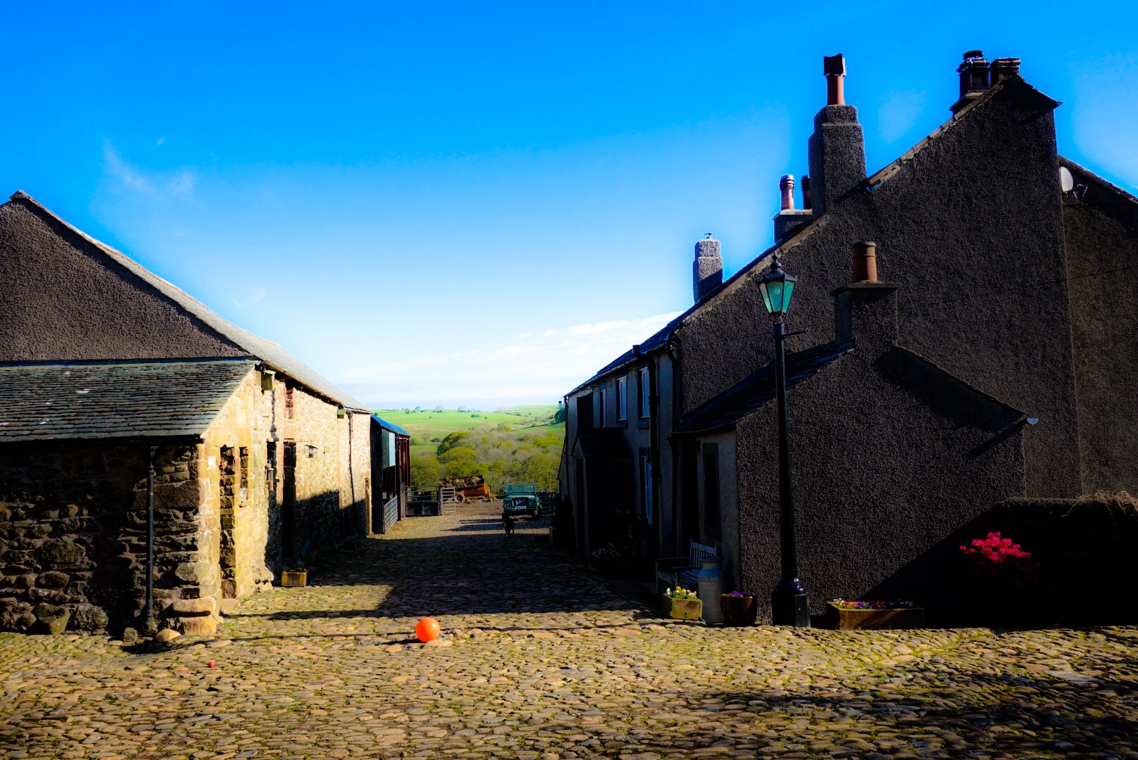
Our 17th Century B&B in Ennerdale Bridge – The Longmoor Head
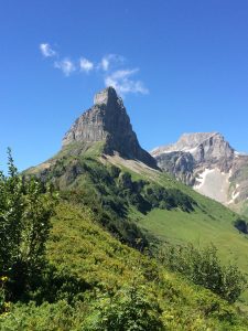
Today was brutal. I picked a walk in England, because I have lived in England and found the countryside always so pretty and gentle. Gentle, shemtle! Joel and I agreed that, today, we had, from the 16 miles we walked, 2 of the hardest miles we ever walked in our entire lives. The hardest! And, Joel has done a lot of out-west USA hiking and I lived 17 years in Switzerland and hiked often in the Alps. This was harder. An endless up-hill and downhill pure-rock scramble. I am at the end of the day now and everything hurts. Joel hurts. He was always ahead. I blame it on his longer legs, but better fitness could have also played a role. Who knows? – But, we are both in pain tonight.
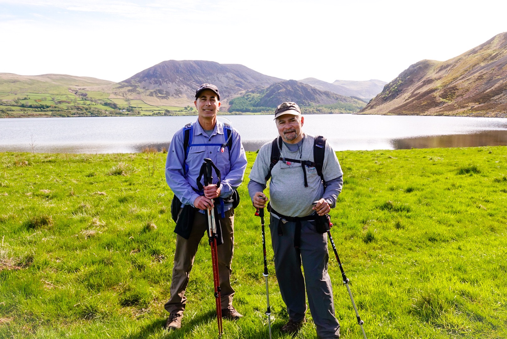
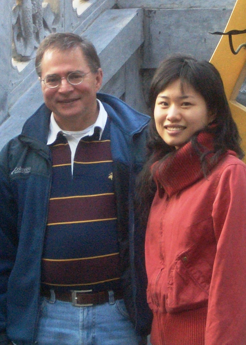
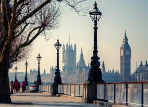
Joel and I in front of Ennerdale Water
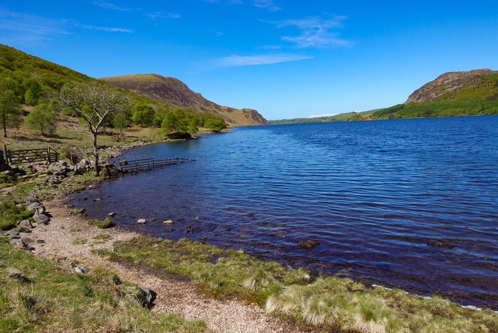
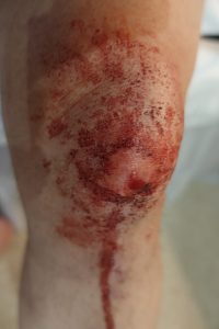
Even the flat part, along Ennerdale Water, was just rocks, nothing flat, every step needed to be calculated, intentional. I bloody a knee, and was lucky that was all.
Path along Ennerdale Water – Rocks, only Rocks..
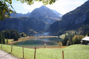
Ennerdale Water was beautiful, but we were happy to put it behind us. We had a 16-mile day ahead and managing the rocky path along the lake took up too much time.
Putting Ennerdale Water behind Us
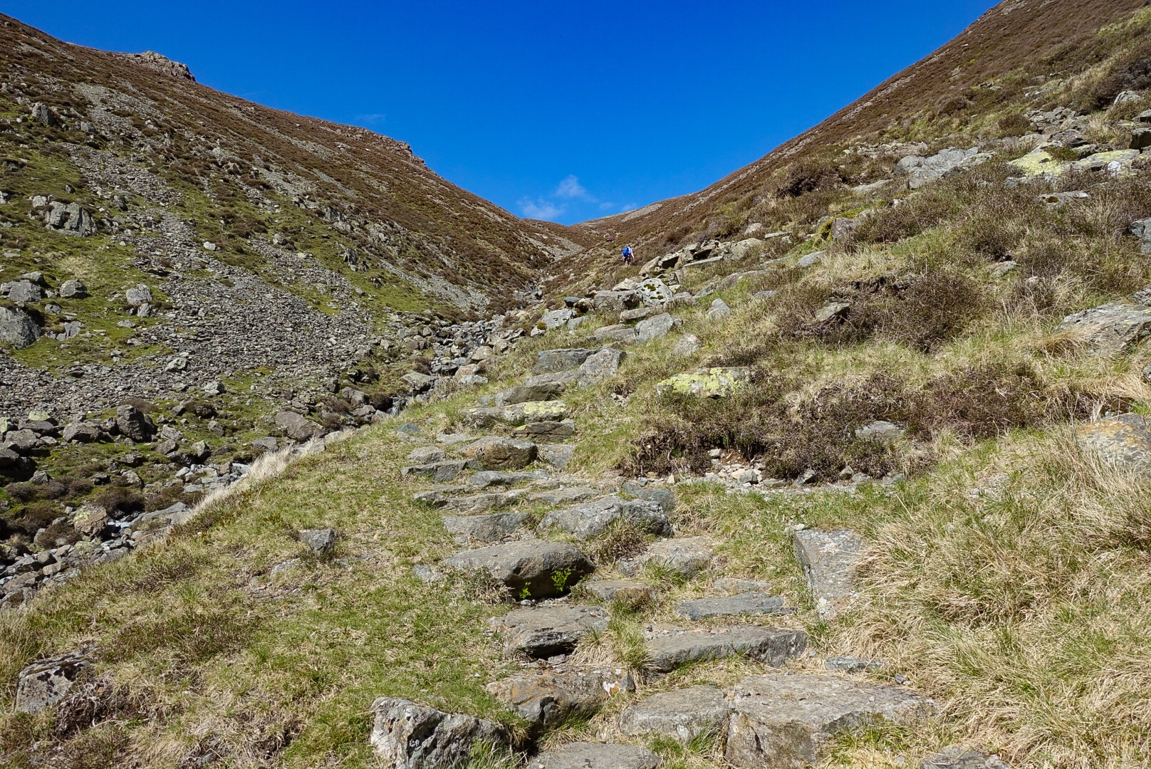
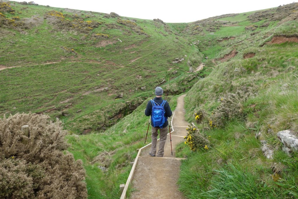
We had a gentle upwards bit after Ennerdale Water, walking up the valley, but the top of the valley finally meant that we would need to go over a pass. This was the hardest climb I have ever made. A one-mile rock scramble upwards.
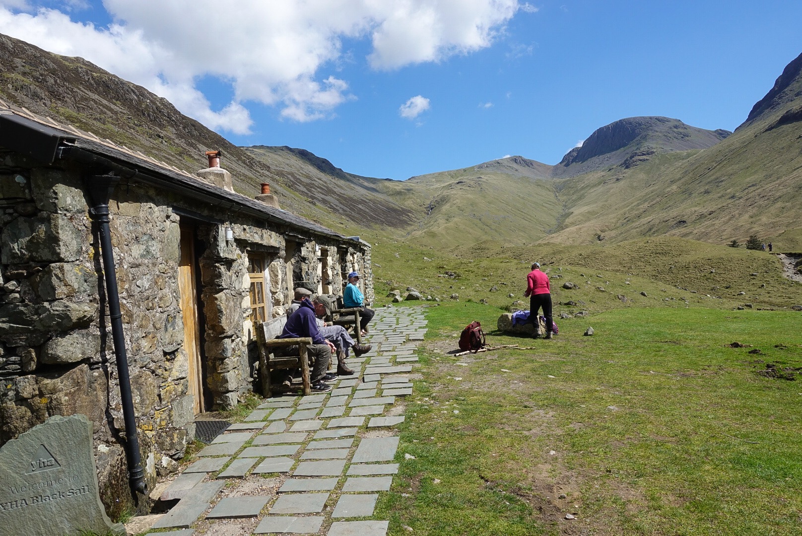
A nice-looking Youth Hostel at Scarth Gap, the Top of the Valley, just before “The Climb”!I wish this pass looked in the photo as bad as it was! But, this was over half-way up and the stone “steps” are visible.Bloody Knee – Sorry for Gory Photo!
I took one stumble and scraped my knee (see photo, but only if you don’t faint a at the sight of blood!). I am alright, though. Superficial wound. Knee cap still in place.
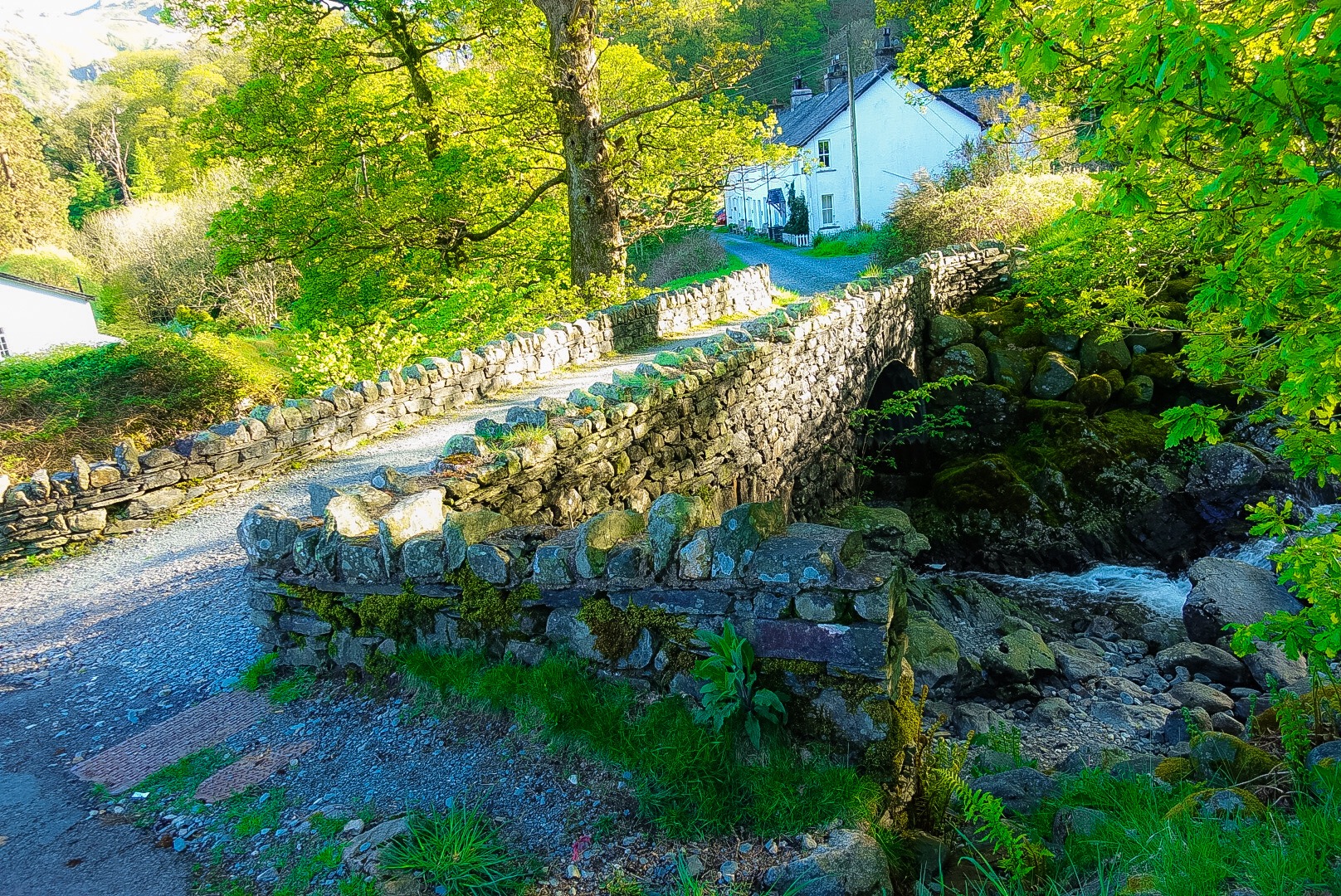
But, eventually, this pass was behind us and we re-entered civilization. A charming bridge over a charming stream, with a charming cottage in the background – see photo below.
We are staying in a very quaint hotel tonight, and our walk tomorrow is “only” 9 miles, but includes another big uphill. Hopefully, we are in our next B&B in time to enjoy it, and to recover, and to wash some clothes. We still have two more days in the Lake District and a 21-mile day marching out, before we have our sort-of mid-way day off, I think, this coming Thursday. More on that in the next post.
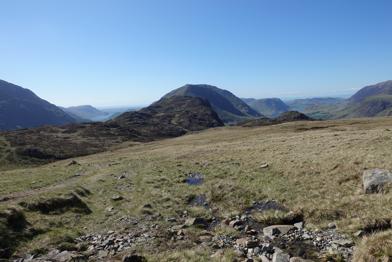
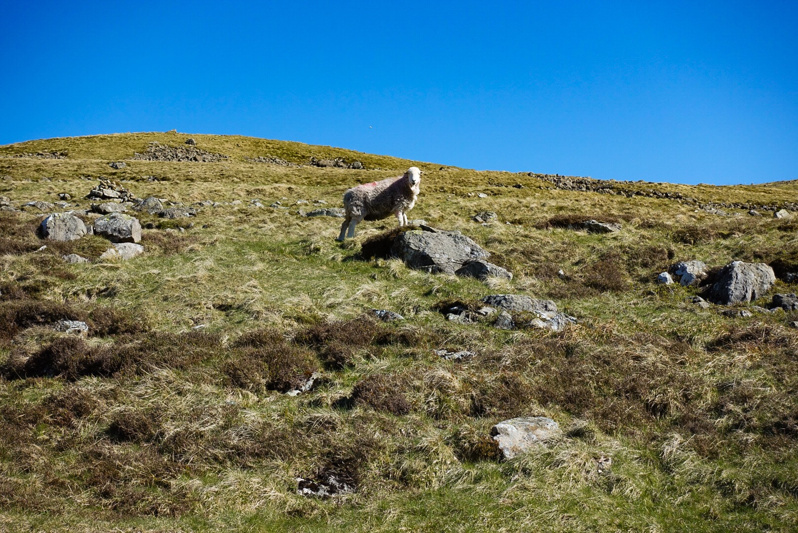
View of 2 Lakes – Ennerdale Water and Buttermere (I think)Just a SheepBack in Civilized Parts, still 2 miles Away from our Hotel in Rosthwaite
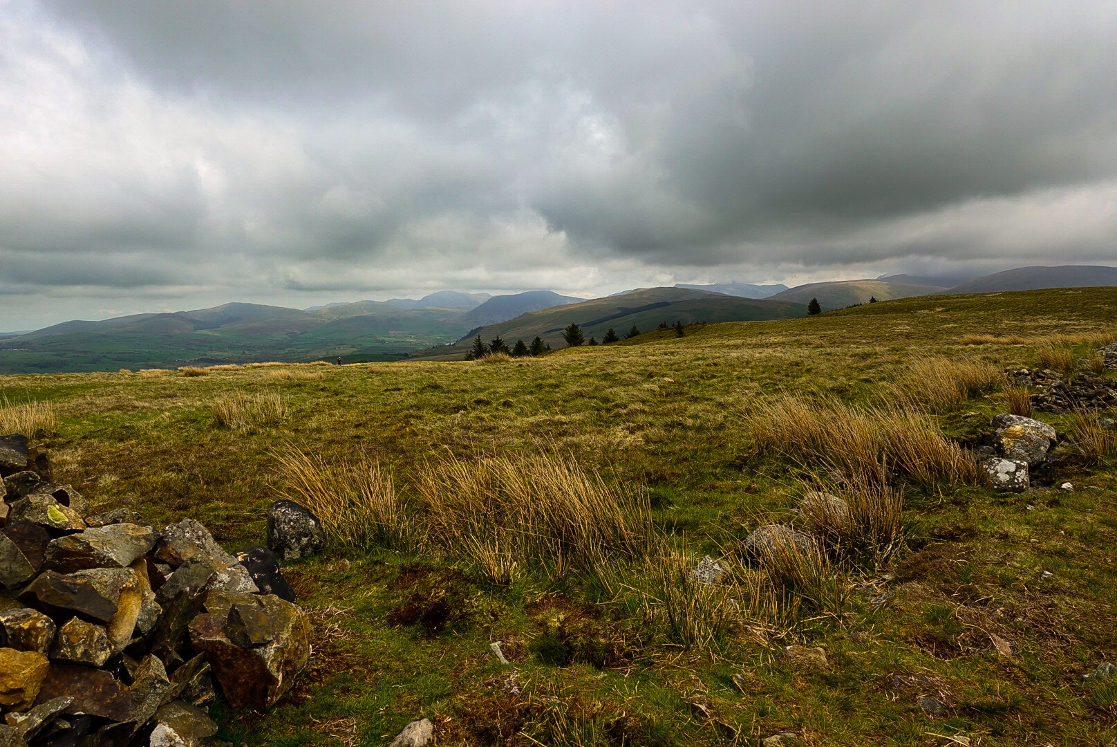
Today, I need to keep my commentary short, which is hard for me to do. Tomorrow is a long day, 15 miles with a big “up and down” at the end. Today was also not easy, but we are now solidly heading east, across England. We walked about 12 miles from St Bees on the coast to Ennerdale Bridge, the gateway to the Lake District.
Heading east, with the end of our walk yesterday on the other side of The Valley.
Just a side note: After I posted yesterday, I went onto the blogsite and saw a dozen typos and other mistakes. Yikes! I tried to correct everything, but it took about a half hour. If you opened my posting yesterday before that half hour was over, you would have seen all of my mistakes. You can read it again, if you like. It is mainly fixed, I think. Actually, that will probably happen with every post. I write at the end of the day and I am beat!
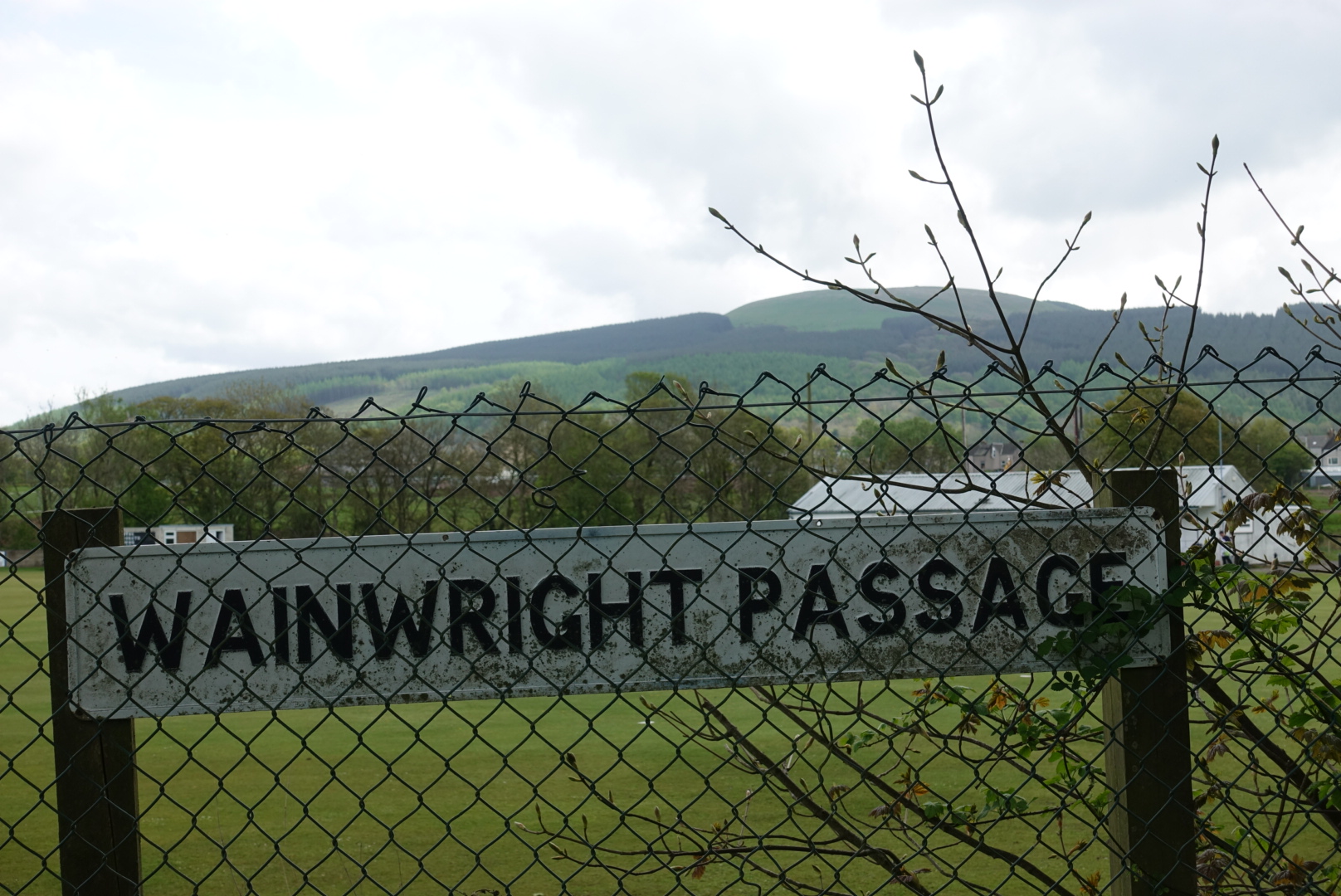
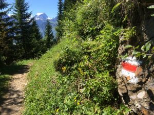
A “Wainwright Sign” – He is all over the Place with his Famous Walk!
Behind the “Wainwright Passage” sign in the photo above is Dent Hill. It doesn’t look like much, but it was nearly a 1000 feet straight up and straight down, not even a switch-back trail – STRAIGHT UP and DOWN! That is hard on the feet, which, especially on the way down, are pushing against the front of your boot. Painful!
Top of Dent Hill, Looking into the Lake District and All of the Hills Ahead!
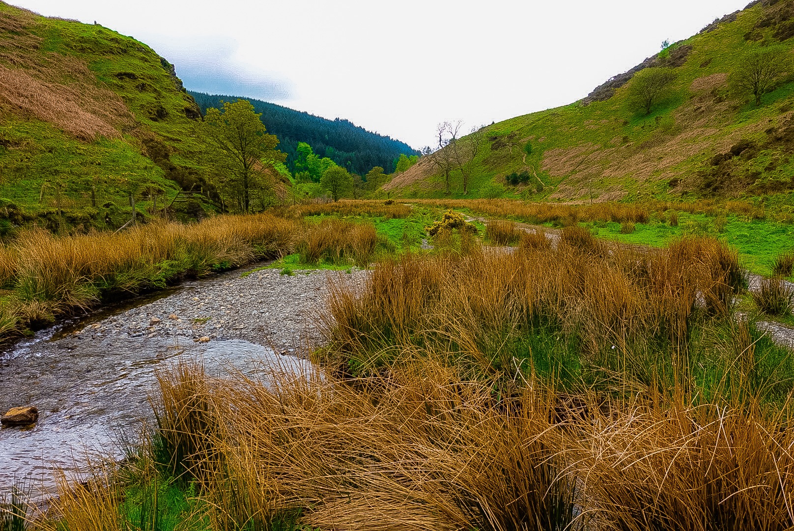
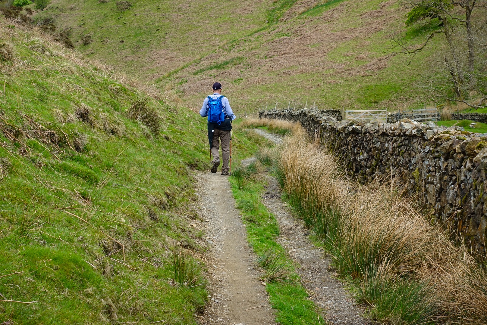
After putting Dent Hill behind us, we were rewarded with a beautiful little valley, with a pretty stream running through it – Nannycatch Beck (really, that’s the name!). We had lunch, but felt our legs stiffening up – at least mine were and I am only making an assumption about Joel’s legs.
Along Nannycatch BeckJoel Walking Along Nannycatch BeckAlong Nannycatch Beck
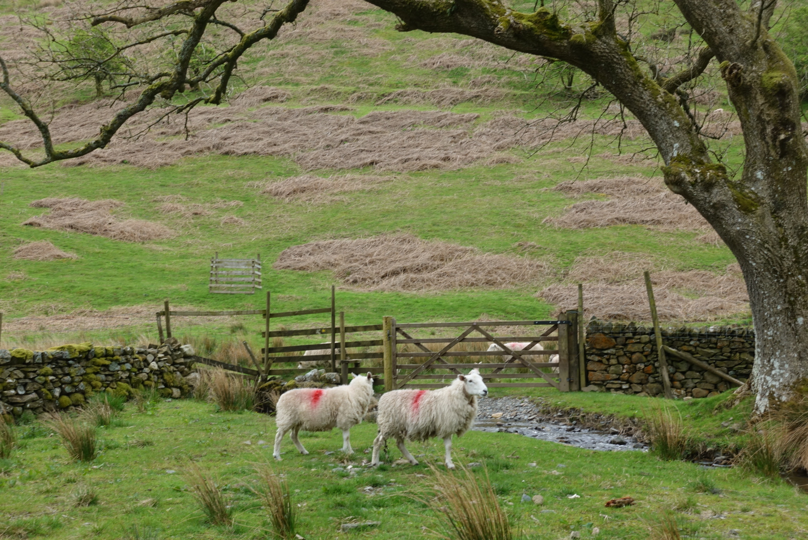
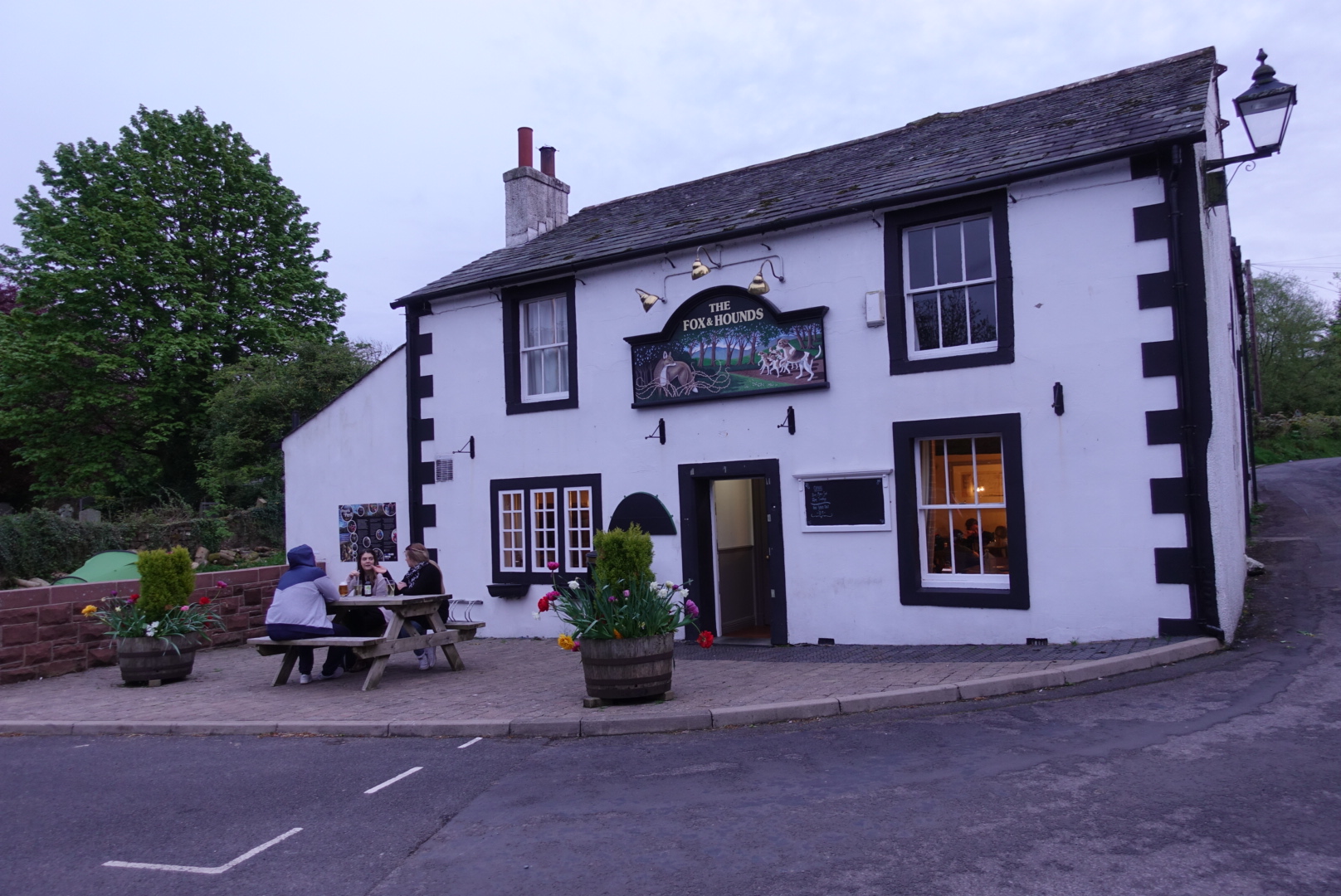
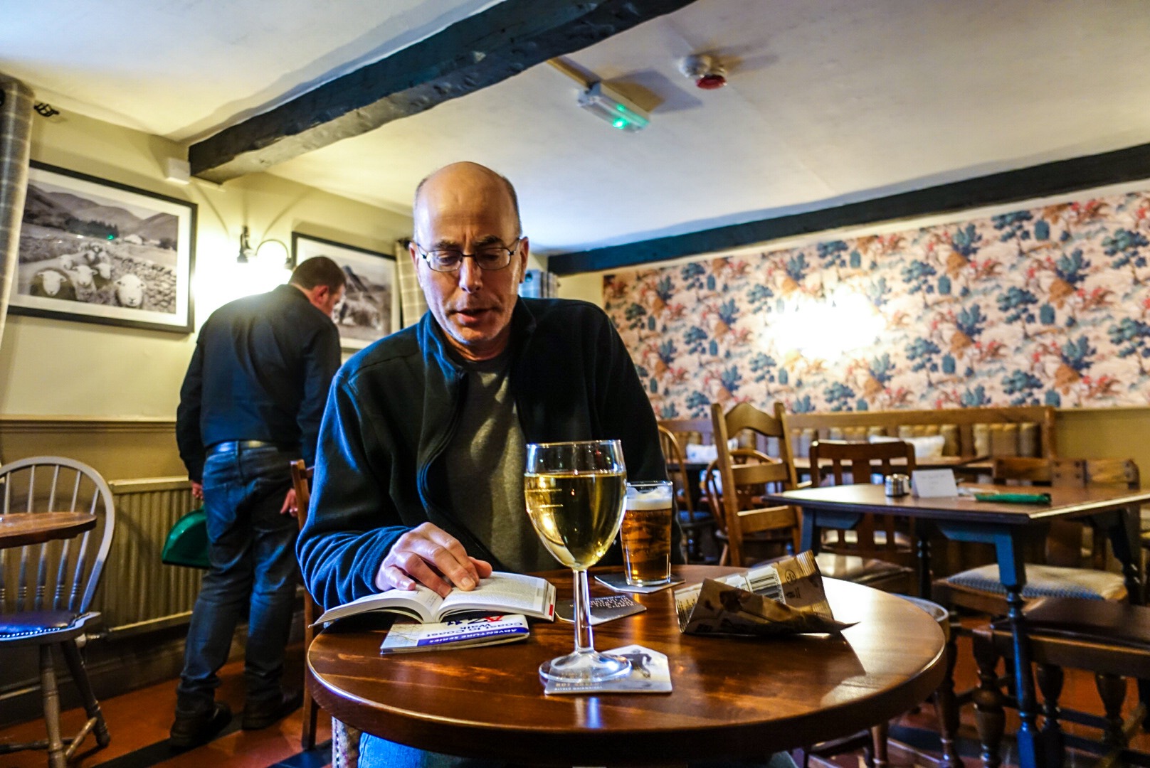
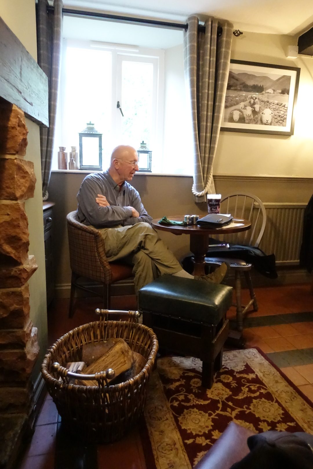
Happily, after coming out of this picturesque little valley, we had a mainly downward sloping trek into Ennerdale Bridge. I will post a picture of our 17th century B&B tomorrow, but today I snapped only a shot of the 17th century pub, where we had our dinner, and where we met a number of Coast-to-Coasters, including Bob from Washington D.C., who has hiked everywhere in the world – literally!
17th Century Pub – The Fox and Hounds17th Century Pub – The Fox and Hounds – Joel Studying Tomorrow’s Route17th Century Pub – The Fox and Hounds – Fellow Coast-to-Coaster, Bob, the World Hiker!
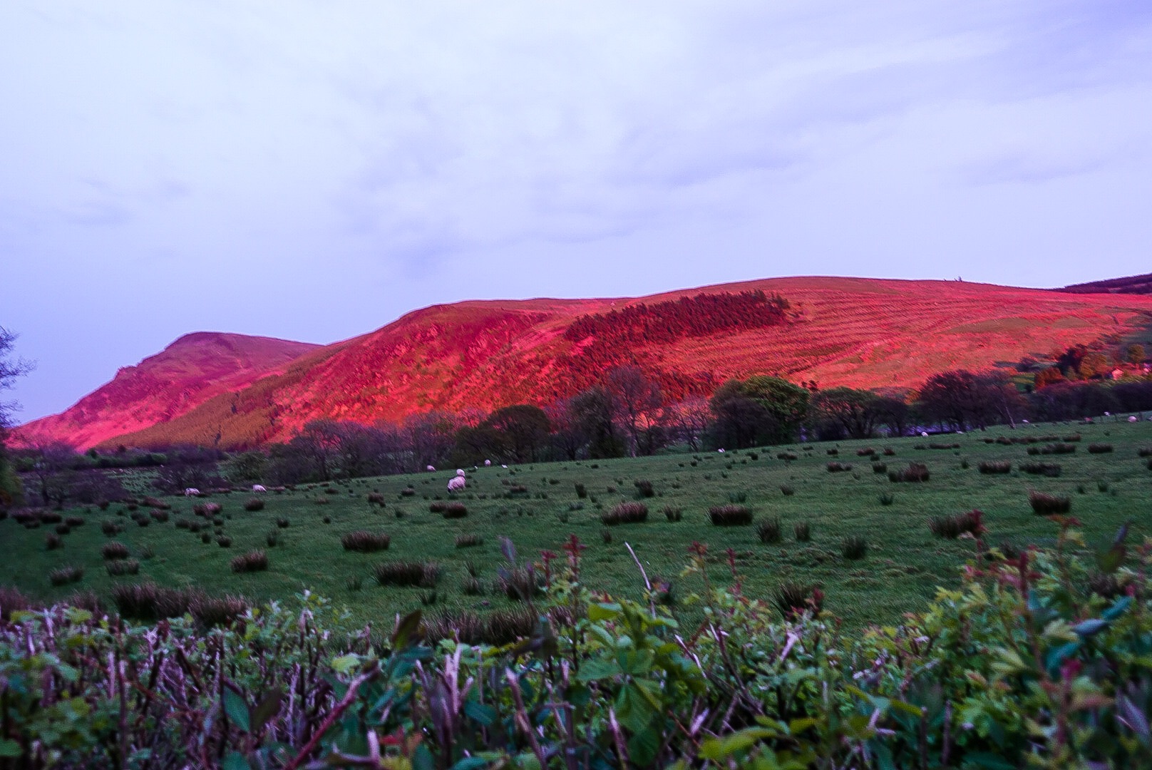
Walking back from the Fox and Hounds, the sunset treated us to glowing mountains. Our B&B hosts, Joan and Richard, told us that we are forecast fantastic weather for our next days in the Lake District! I will post the glowing mountains and sign off for tonight.
Sunset Reflected off the Mountains of the Lake District
After we flew into Manchester, at the airport already, someone with a backpack came up to us and asked where we were to going to hike. We said we are walking the Coast to Coast, but first taking a day in St Bees to partially recover from jet lag. He said he had walked the Coast-to-Coast several years before and suggested we walk the start of the walk on our first day, since it actually circles back on itself, within a couple miles anyway, and, then, we should go back to St Bees for the night. Having started the walk, we would break the first long day into two parts, he would recommend it. We had actually heard already of that possibility in our reading about the walk, but discarded it, because we didn’t want to walk a day and be back in the same spot. Philosophically, it seemed not right.
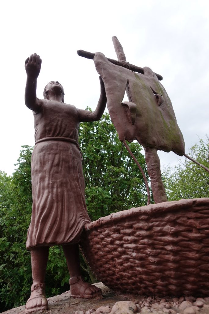
St Bega arriving from Ireland in the 8th or 9th Century
Then, the B&B owner, seeing that we were staying two nights, said that we should walk the first part of the walk on our first day, shortening the second day’s walk. We thanked him, but said we didn’t really want to be in the same place after a day of walking. At dinner that evening, our waitress made the same recommendation. Joel and I decided we should maybe evaluate this option more. Was it cheating?
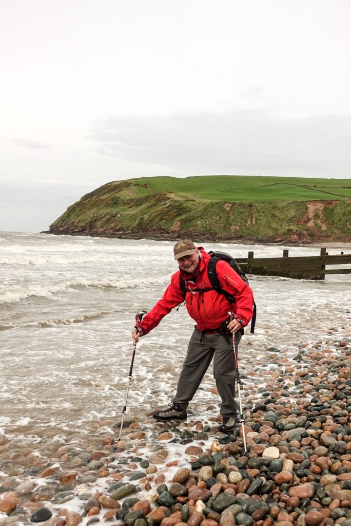
Traditional Sticking of Boot into the Irish SeaTraditional Sticking of Boot into the Irish Sea
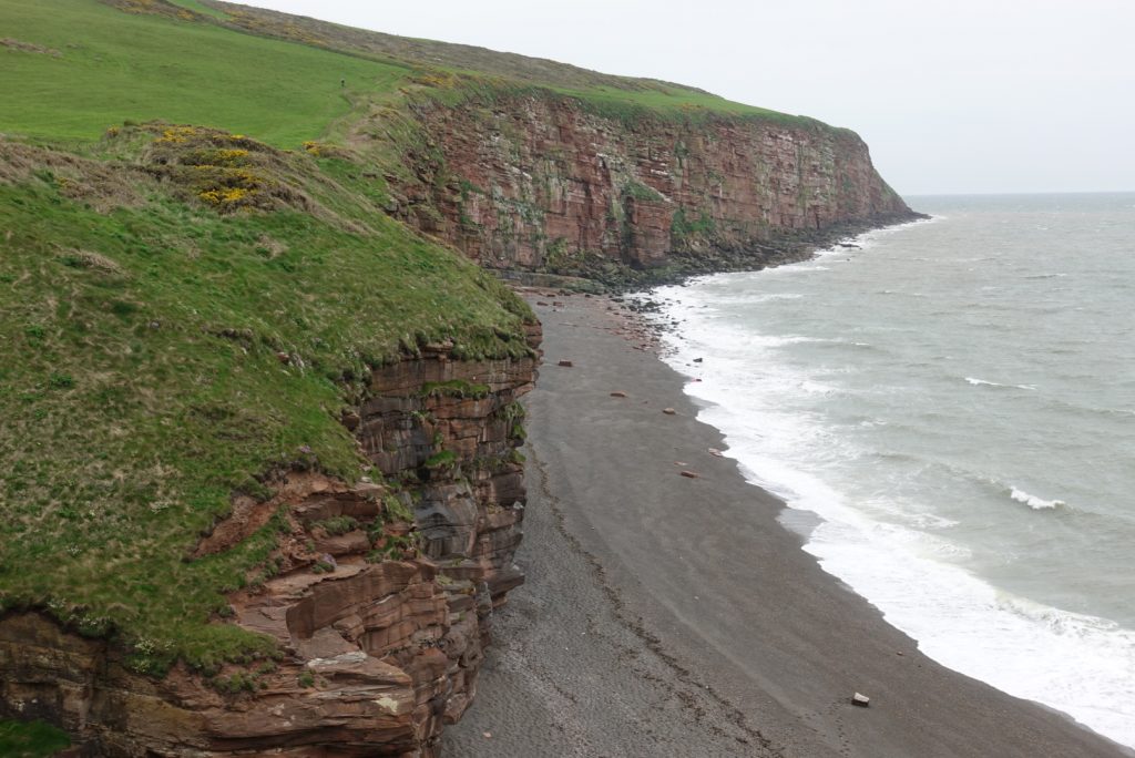
Well, actually, Alfred Wainwright had designed the walk to circle back on itself, because it was important to him to have the C2C walkers spend the first part of the walk on the cliffs above the Irish Sea. The west-to-east cross country walk actually begins in a north-westerly direction for several miles to achieve this. It is counterintuitive, but that’s what it does.
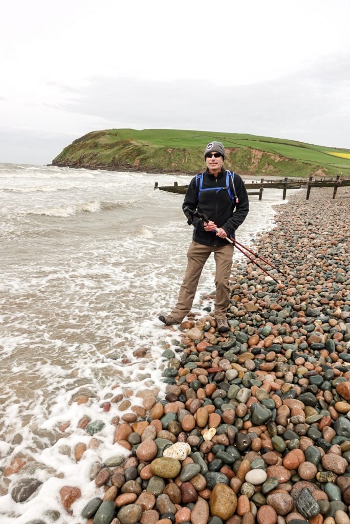
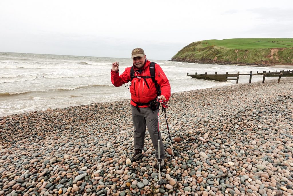
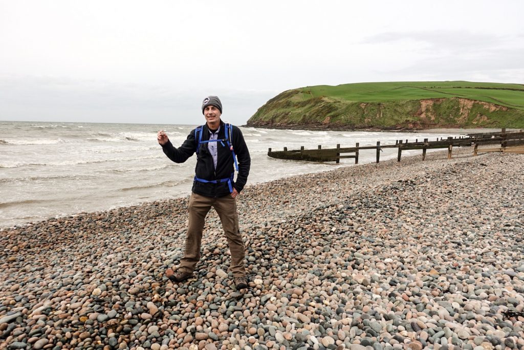
Traditional Collecting of a Pebble from the Beach at the Irish Sea to be dropped into the North Sea at the End of the WalkTraditional Collecting of a Pebble from the Beach at the Irish Sea to be dropped into the North Sea at the End of the Walk
The walk does wind back on itself. That was not our design, but the established route of the walk. We will, at other points of the walk, need to stay in a B&B not directly on the trail, so that was not anti-theoretical for the walk to sidetrack a bit to go back to St Bees. Then, there was the prospect of two short days starting the C2C walk versus one long day. It wasn’t really cheating, we wouldn’t be interrupting the solid line of our walk across England. Maybe, it was a good idea.
Alfred Wainwright – Designer of the C2C
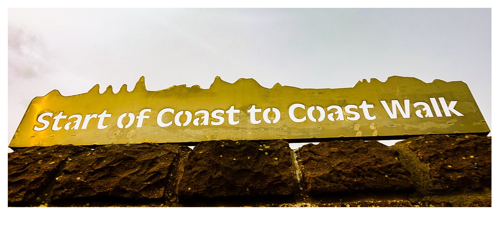
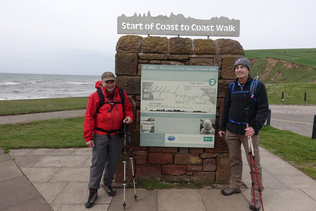
We decided that it was a good idea. So good, in fact, that we soon had ourselves convinced that we had come up with the idea ourselves, and had intended it that way the whole time. And, we did it. We started the walk today. We consummated all of the start-of-the-walk rituals. On the beach at the Irish Sea, we dipped our boots in the water, then we collected our pebbles that we would carry across England and drop in the North Sea at the end. Then we went to the “Coast-to-Coast Wall” for a picture. And, then, we headed up to the top of the cliffs over the Irish Sea, and continued north west!
Official Start of the C2C
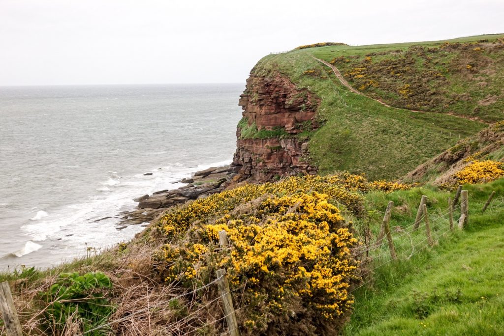
It was a tough start. The wind along the top of the cliffs was blowing in 50 or 60 mph gusts – non-stop, constantly! It was a struggle walking in it – for miles and miles. It was chilly. The ground was never even. Good that we were breaking this first day into 2 days!
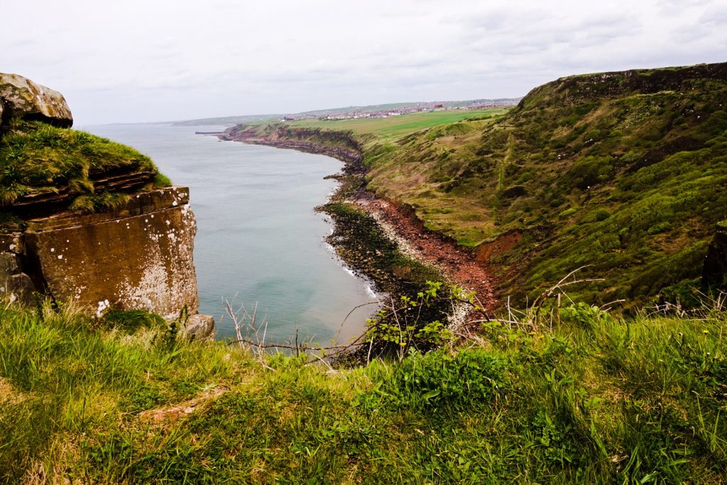
Along the CliffsAlong the CliffsAlong the CliffsAlong the Cliffs
After forever, we made the turn east. We were now walking across the country! It didn’t take that long, after that, to get lost. Actually, we made it impossible to get lost on the C2C. Joel had acquired a GPS app for his phone and downloaded the whole walk. A little arrow on the screen is always “us” and as long as that little arrow is on the trail, we were on the trail, and we were alright.
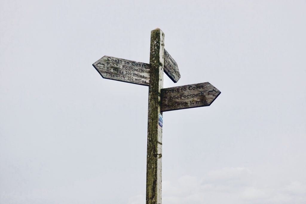
Coast to Coast Sign
But, we had to leave the trail to walk back to St Bees. It was supposed to be easy. We pick a trail, which we were advise to take at the B&B. Something went wrong, we got our directions crossed, we dead-ended at a murky creek that was just about the 6 feet wider than we wanted to wade. We turned around and added several miles and an uphill to our “short” first day walk. A kind farmer and his daughter put us on the right track, though Joel and I recounted the instructions they gave us after they had left and had heard two different versions of their instructions. Was it the dialect of the area? After a number of uneducated guesses and some dumb luck, we stumbled back into St Bees nearly an hour later. We just had dinner. I had 2 glasses of wine to numb the pain in my feet, legs and back. I am heading to bed now. Below are two photos of the St Bees Priory Church.
The original priory was founded by St Bega. She was an Irish princess who sailed to England in a small boat to escape an arranged marriage with a Norwegian prince. She landed and and decided to found a priory. She asked a local landlord for land, on which to start her church. The landlord told her that she could have all the land covered by snow on the next day. It was midsummer. Well, of course, a large area of land was covered in snow the next day. St Bega was a saint, after all. With that, I will post two picture of the priory as it looks today – the oldest surviving parts date back to Norman times. Now, I am going to bed!
I needed to shove in one more post. I made 15 miles on Saturday. The disance was pyschologically important, and I set it on purpose. An average walking day on the C2C is 15 miles. Our first 2 days will be 15 miles each. I planned to do another 15 miles on Sunday, but I was invited to a Cinco de Mayo party in the evening, and I was, unfortunately, not disciplined about my food and drink intake. In short, I skipped the next day 15-mile hike. That won’t be a choice on the actual walk.
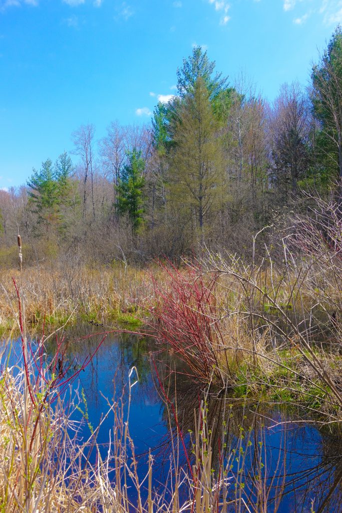
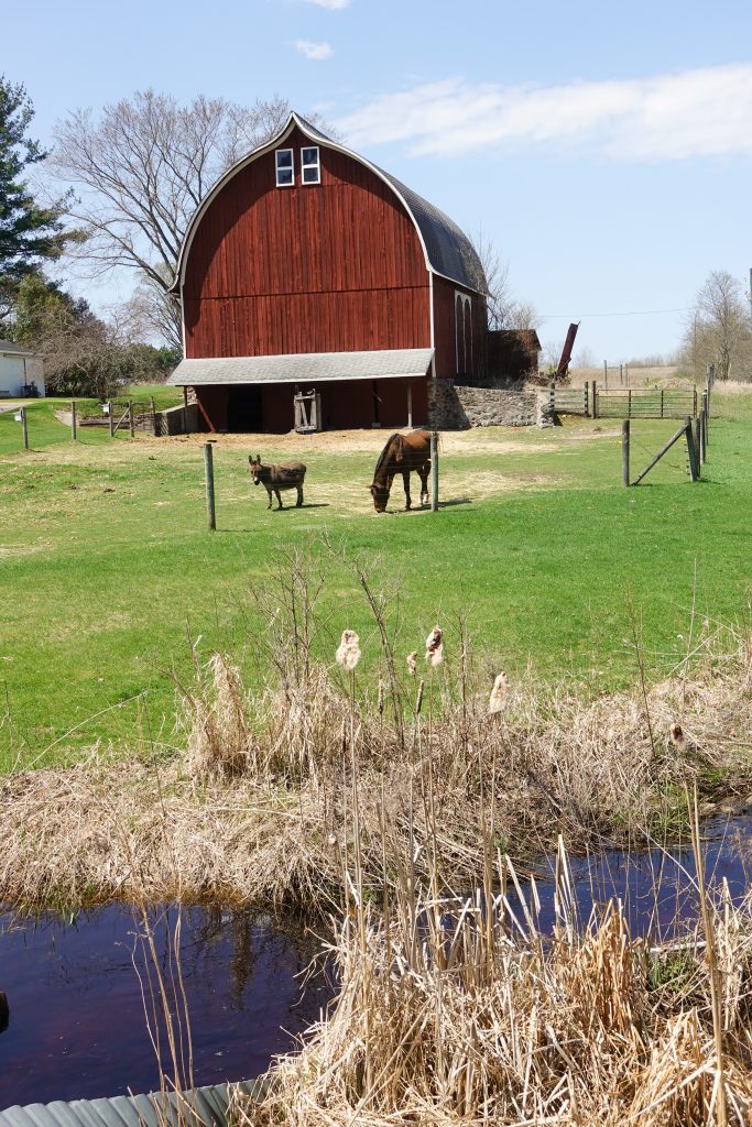
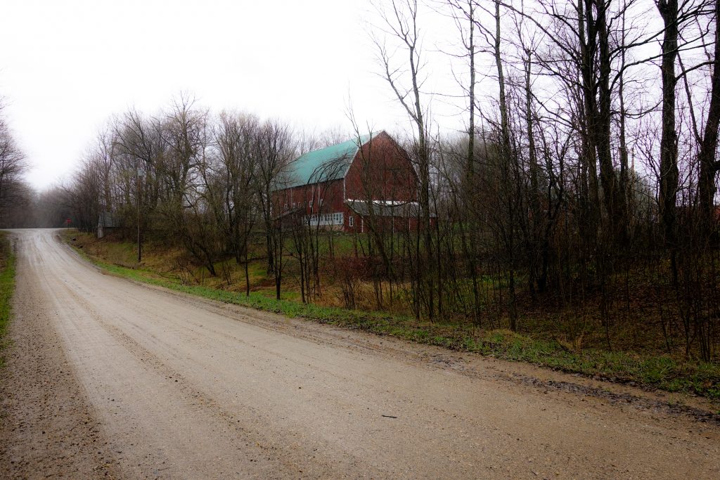
A Wetland near the Village of Tustin
I felt fine until the end of the walk and for about 30 seconds afterwards. Then, everything stopped moving. The two toes on my left foot that I dropped the pickle jar on last week felt just plain broken. I thought this is not such a good sign. But, 3 hours later, all was fine again! Maybe I will have that bounce-back resilience, in order to do this walk, day after day after day… Maybe!
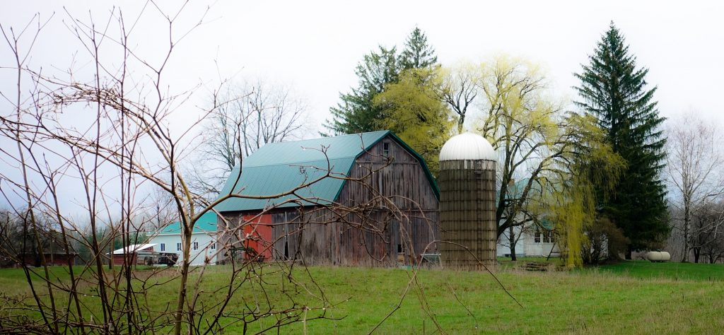
A Pretty Barn near Tustin
Well, I announced that my last post would be my last post before take-off. This one certainly will be. I have done a “dry-run” of my packing, noting down some last minute stuff to shop for tomorrow. Little thngs.
The schedule goes now – I fly from Grand Rapids to Newark, New Jersey, on Wednesday. There, I meet up with my walking buddy Joel for the flight to Manchester, England. From Manchester, probably already Thursday, due to the new time zone, we will take a train to St. Bees, the village that begins the walk. We have given ourselves Friday for “acclimating.” I will take pictures of the village and write a post on Friday. I can imagine that the posts, the writing at least, may become a bit shorter on the walk. I will hit the highlights, and post pictures. Many mundane factual details can be googled, I suspect.
After crumpling together after 11 miles on Tuesday, I was a little panicked about my 193 miles across England. How is this guy going to walk across a country?! Many of you wrote your concerns for me, which was touching. Thank you!
Yesterday, I set a less ambitious goal and walked 9 miles in a chilly rain. It
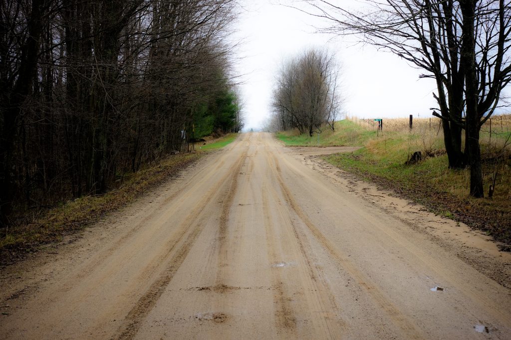
17 Mile Road – Dirt
went without a hitch! Well, my right hip ached a bit and the toe next to the big toe on my left foot was hurting. But, these are completely explainable pains and nothing to worry about, I think.
My hip ache was due to the 2 dozen bone marrow biopsies they did on my hips. (If you are squeamish, skip ahead a few sentences!) When they do a bone marrow biopsy, they stick a long thick needle into your hip, being a big bone, and extract plugs of bone marrow, which they needed to examine regularly when I had my leukemia, and for 2 years after. The holes in the tissue from the skin to the bone healed up and created channels of scar tissue. I have a large number of these channels of this scar tissue in my hips. You can stretch the tissue out again with exercise, which I have been doing, but it is still an ongoing process. This long walk will likely help break down the scar tissue, but I will need to put up with a little discomfort in the process. But, not a big deal. I have a good ability to isolate localized pain. I am a tough guy!
Now, the pain in my toe on my left foot is fully explainable by the pickle jar I dropped on it on Wednesday! That was dumb.
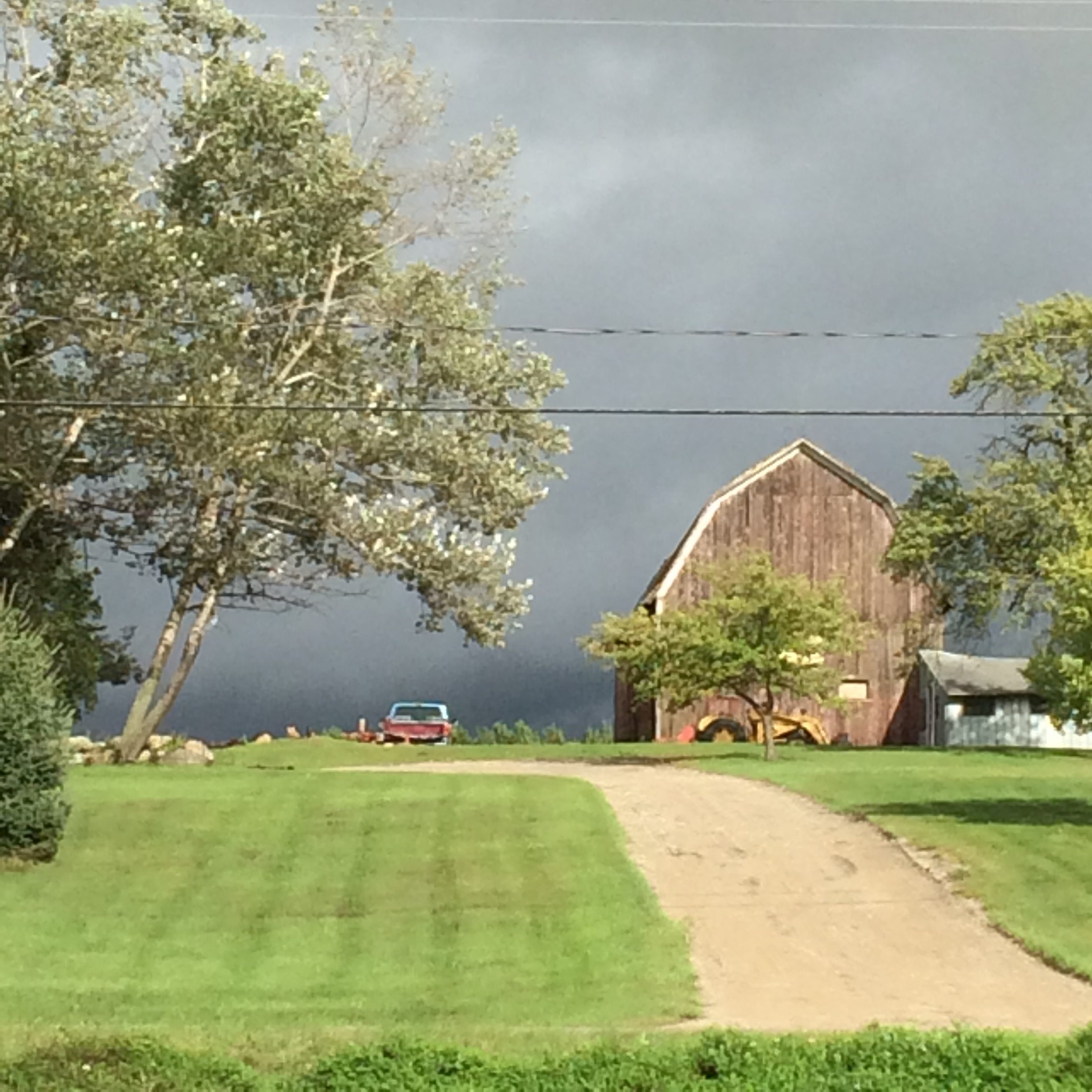
A Lot of Barns Around Le Roy
So, all is well. Okay, I know that I haven’t done a full day’s walk yet. I will do a few more walks before leaving next week. The soreness in my soles has diminished, and I finally fell into that rhythmic meditative cadence on the walk yesterday that I used to experience all of the time on hikes in past years. I can do this! (And, if not, I am sure there are taxis in England.) My walking buddy was, at one point, an avid long-distance runner. He also has some wear and tear issues to deal with. But, well, consider this all an aspect of our walk which is suspenseful! What is a journey without some suspense?
Besides, the rain and the cold yesterday were likely an excellent preparation for walking in England and, for me, much better than the over 80°F sunny weather I walked in on Tuesday. What is more likely on a walk in England? One guess! Other differences to Tuesday were that I was mainly on dirt yesterday (versus asphalt), and I used my hiking poles.
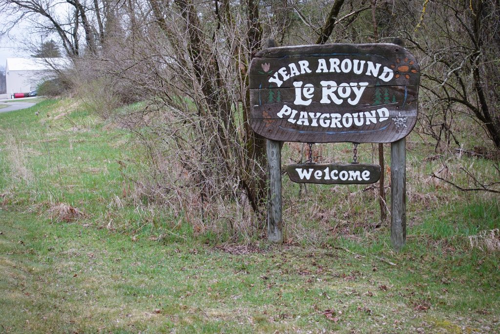
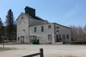
Welcome to Le Roy, Michigan
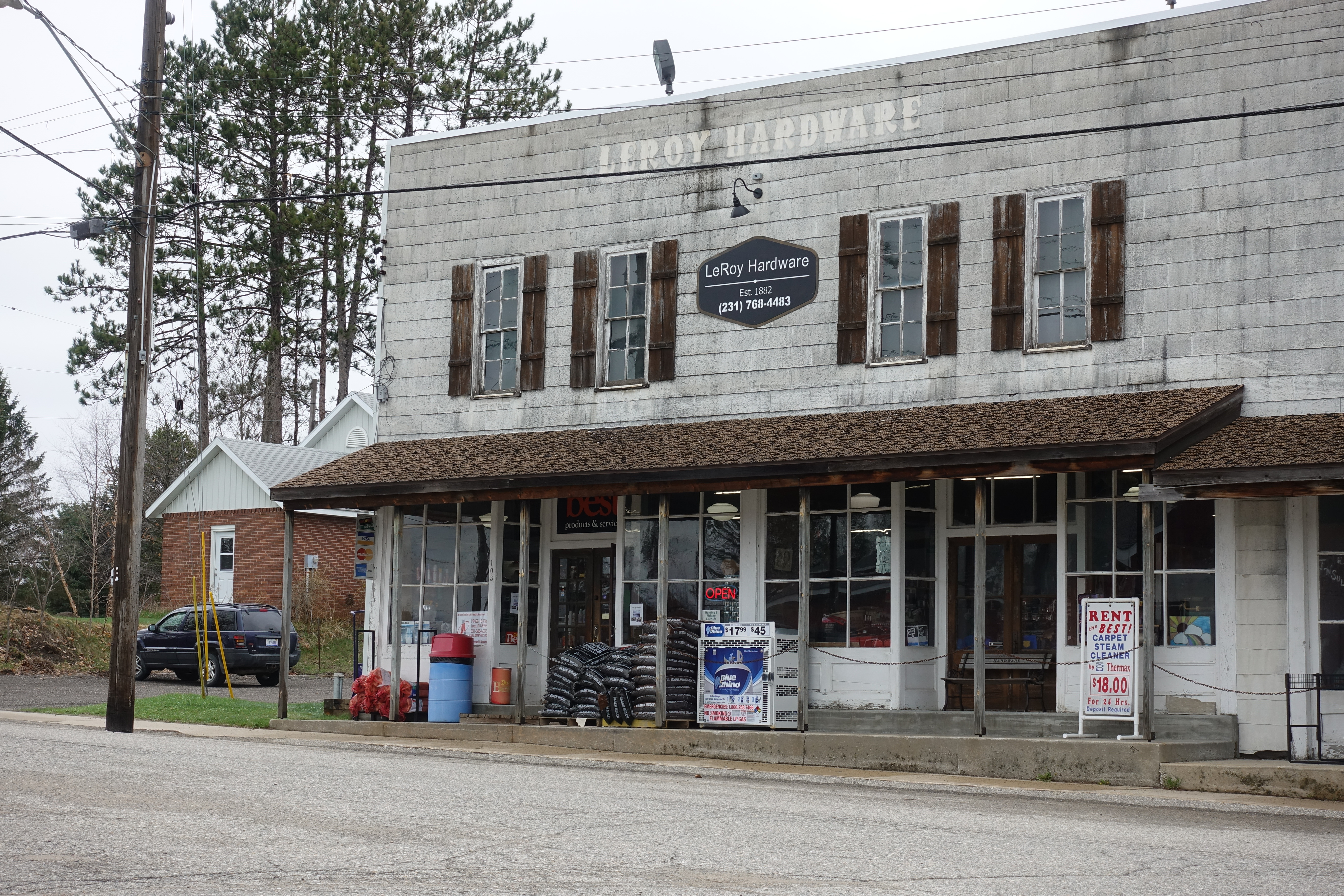
I went up a dirt road next to the house until it dead-ended in about 2 1/2 miles, then I came back to where the road met the White Pine Trail, and took that in the opposition direction from Tuesday, to the hopping-happening town of Le Roy (pop. 256), the other of the twin cities I live between. It was “founded” in 1837, and also immediately had a couple of lumber mills. Le Roy distinguishes itself from Tustin in that it has one church (I think) and one bar. Tustin, as you may recall, has three churches and no bars. I like Le Roy better than Tustin. (Sorry, Tustin – open a pub!)
Le Roy Hardware, founded 1882
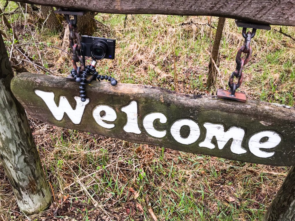
Other photos just show little scenes on my walk, including the 136 year-old hardware store in Le Roy, and the town’s welcome sign, to which I attached my camera for my selfie above – again, remotely snapped from my iPhone.
My Camera Mounted on The Squid!
Now, to the walk – the real one: Joel and I are leaving on this coming Wednesday. We lose 5 hours flying to Manchester (if you are starting in Eastern Standard Time – Joel loses 8 hours from San Francisco), so we don’t actually arrive in St. Bee’s, the start of the walk, until Thursday evening. To acclimate to the time zone, we are spending Friday in St. Bee’s and departing for our first walking day on Saturday. I may try to post again before leaving, but Friday could be my next post.
Alea iacta est (“The die is cast”)! My physical fitness, gear, all of the travel and overnights – everything is set and little room left for more changes – none, actually. Let’s see how it goes! – Suspense!
My trial walk – well, it didn’t go as planned. Up to mile 7, all was well. A little soreness on the bottom of my feet, but that was to be expected. I am still – quite literally – a tenderfoot. All of my gym exercising has been on gym equipment. Nothing simulated the 10,000 times that I would stomp on my feet on a trail, rolling off of the balls of my feet and toes with every step. By mile 8, then, I was hobbling. My hips were also beginning to hurt. By mile 9, the wind picked up and blasted some kind of pollen in my face. My eyes watered and my nose ran. My vision started to blur and my heart felt funny, but that turned out to be gas (pardon).
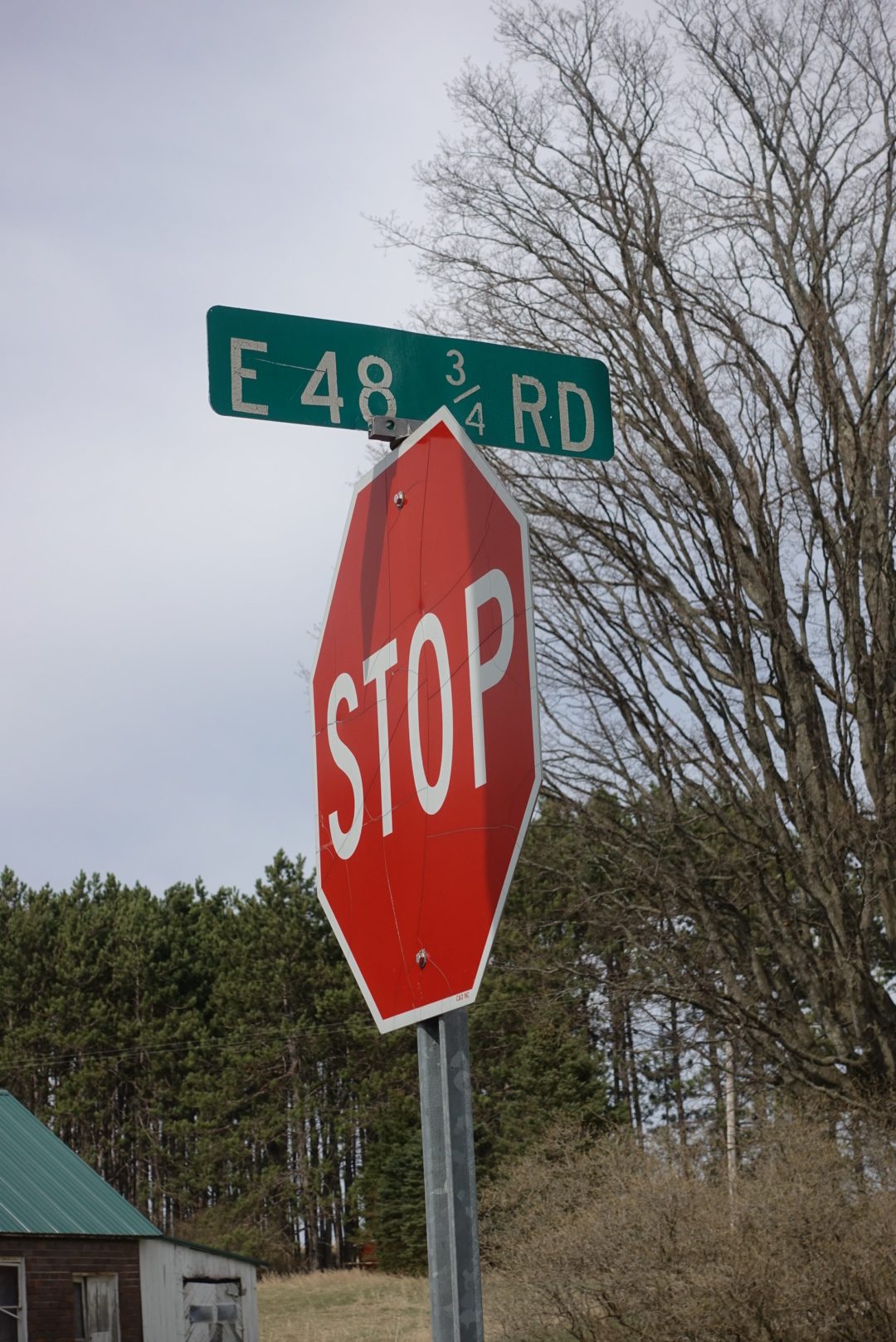
At mile 11 of the walk, I was at the first intersection I had seen in a long while. Two dirt roads crossing each other – I was at the corner of S 37 1/2 Road and E 48 3/4 Road. I did some map calculations and it was still 5 miles to Cadillac. So, I did what any intrepid courageous outdoorsman would do in a situation like that, I decided to quit. I called my sister to have her rescue me. No sense dying on a practice walk.
”You’re at the corner of what and what? Wait, I’ll check my county map and call you back.” A few minutes later, my sister called back, “I have found you, I am coming.”
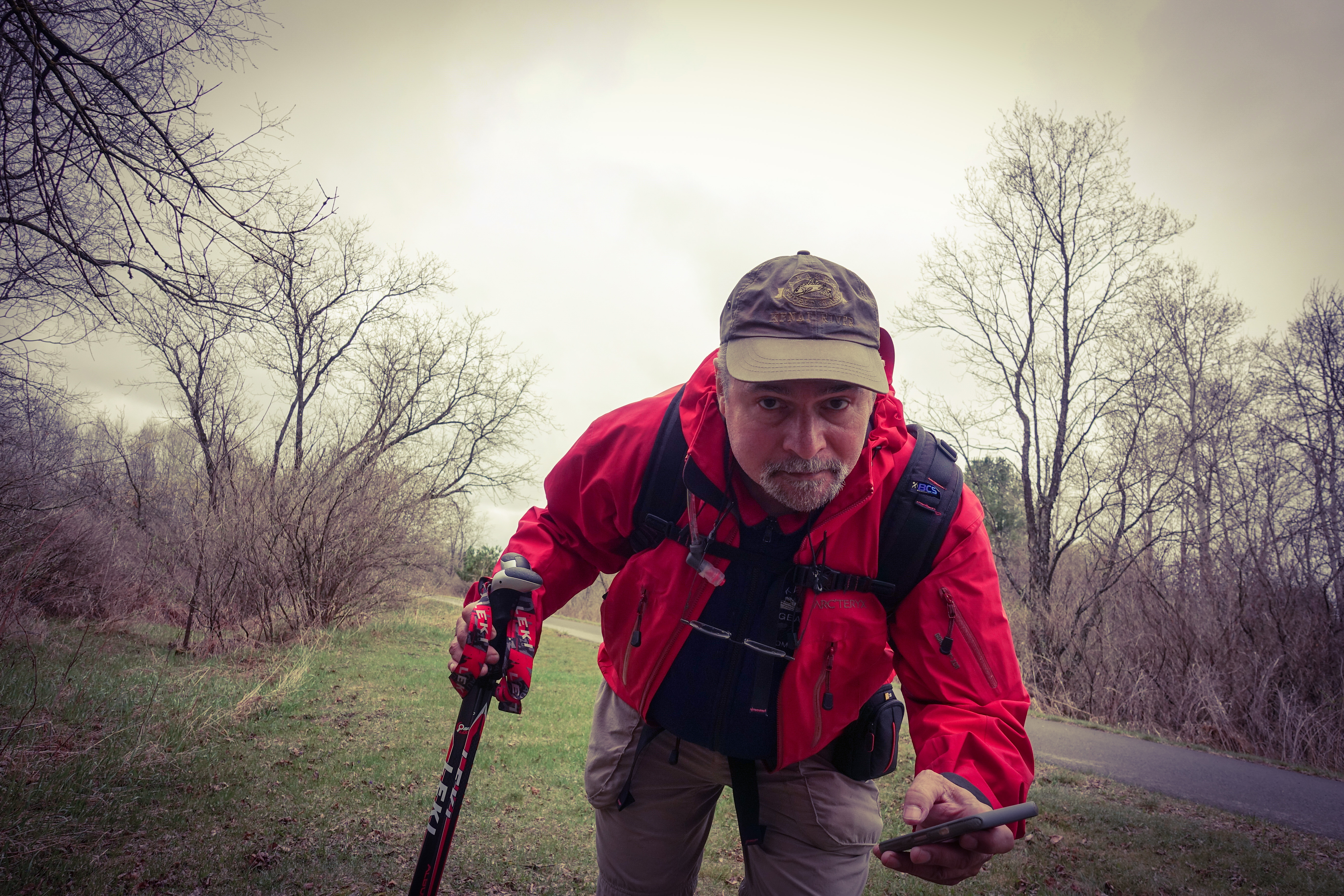
A Selfie on the White Pine Trail
Okay, I will start back at the beginning. The first thing I wanted to do after hitting the trail was to test my new camera, remotely. The “selfie” you see of me on the tail was actually taken over a remote connection from my mobile telephone to my camera. But hi-tech doesn’t necessarily mean good photos. I am writing this post from my iPad and it is too hard – or, at least, I haven’t figured out yet how – to doctor up pictures on my iPad. I am silhouetted against a sunny background.
Remote Controlled Camera!
I live between 2 budding metropolises, Le Roy and Tustin, Michigan. I was walking through Tustin (pop. 230) on the way to Cadillac.
Downtown Tustin, with one Streetlight that only blinks YellowTustin Lumber – Closed
Now, Columbus Tustin founded Tustin as a lumber town in 1868, though it really didn’t get anywhere until the 1880s. The town of Tustin, to this day, distinguishes itself by being the only town in the world with three churches and no bars.
Where?
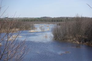
I had it in mind to wait until a large pond I knew on the way to have lunch. I have ridden my bike to Cadillac and back several times, but this was my first time on foot. I walked and walked. That pond seemed like it was never going to come. It was psychologically bad because I knew that I had still 6 miles to Cadillac AFTER hitting that pond!
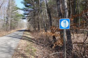
The White Pine Trail is about 93 miles long and it part of Michigan’s “Rails to Trails”
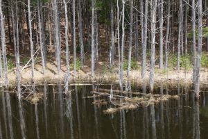
Wetland on the White Pine Trail
initiative, which is turning abandoned railroad lines into trails. The White Pine Trail was naturally once a lumber railway line, which was abandoned when the areas around Cadillac and these small towns were lumbered out. All along it are wetlands, and it is a beautiful trail, when you are not miserable with sore feet, or something. It is a mixed paved and dirt trail. The route from Le Roy to Cadillac is paved. Maybe my feet would have done better on dirt.
Finally, I got to my lunch pond, but my remaining walking miles were numbered in the very low single digits by then. After sitting for 20 minutes eating lunch, nothing on my body worked. I must have been a sight, trying to stand up again. Fortunately, it is not a busy trail.
Lunch Pond
After the humiliating and worrisome abandonment of my walk yesterday, I am pleased to report that I woke up this morning fairly fit. My hips are a bit sore, but I was not expecting not to hurt. My emergency “crunch-time” plan now is to do daily 6-mile dirt road walks from tomorrow, Thursday, to Monday, then stop until the walk, later in the week. The goal is to toughen up my soles. I had no blisters, though! I have also put allergy pills on my packing list.
Well, spring is late in arriving, but it is finally arriving. For this post, I am still reaching back to old photos, but I hope they are interesting ones, anyway. Next Tuesday, I will take a trial walk along the White Pine Trail – which runs nearby – to Cadillac, 14 miles – with pack and my new camera, and attempt to simulate a day on the trail of my fast approaching Long Walk, and I will write about it afterwards.
Calendar Shock
Today, I was stunned by the date and counted the days between now and leaving – 10 days! As much as I am looking forward to the walk, I would shove another week in there if I could. I don’t know why. I would probably say the same thing in a week. For the past 3 weeks, I have been telling everybody that my trip was 3 weeks away, and now it is less than 2 weeks away! I told someone just this week that I had 3 weeks to go. 3 weeks just seems right. But, now, 10 days only! Yikes! I have traveled around my whole life. Why am I anxious about this walk charging up at me? No clue, but I am!
The Great Wall of China
The Great Wall
I need blogging practice and I don’t want to go too many days without a post! Bear with me on this. Thanks!
However, I hope that this will be the last post before the walk using old photos, and a non-walking theme. Especially after my last post about the “Season of Brown” that we have in Michigan right now, I decided on a splash of color.
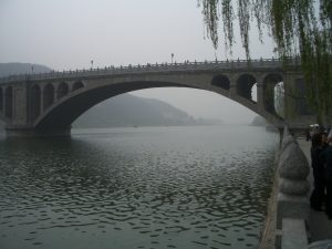
China is very colorful! About 12 years ago, I spent a year and a half traveling back and forth to China and staying for longer stays – 2 weeks to 2 months per trip. I was helping a big Russian company buy a big Chinese company. I don’t even remember what kind of confidentiality agreements I signed in connection with the deal, but I will skip all stories about business-dealings in China, just to be safe, and, instead, show pictures of what I did on the side.
Jeff’s Angels – A Tough Tour of Duty!
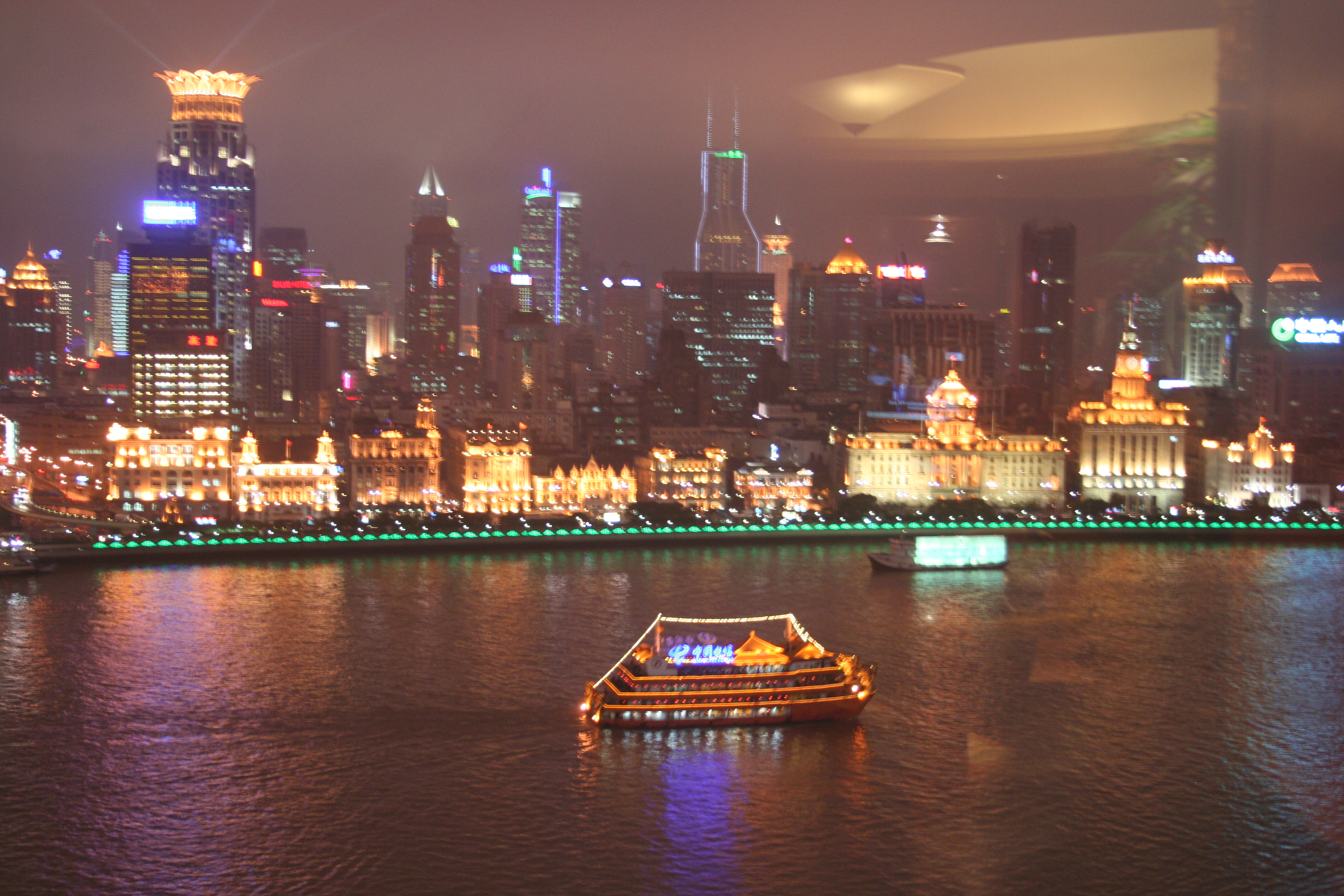
The top photo of the this blog post is very colorful. It is of an acting troop in the town where I spent most of my time. The town is a couple hours’ drive from the gigantic city of Zhengzhou, capital of Henan Province, and is about halfway between Shanghai and Beijing, just more inland.
A Tour of the Town
This town became my second home for 18 months. I also spent a lot of time in Shanghai, Beijing and Hong Kong. From Beijing, I made three visits on separate trips to the Great Wall. It is a sight! The Great Wall is the only man-made feature on Earth that you can see from the moon! It casts a long shadow.
Tai-Chi with Liang-Li
Maybe, you think that the Chinese don’t like Americans, but I can correct you on that. I was treated like a rock star! People actually stopped me in the street to have a picture taken with me! Three university students, who were hired to help out with me and my – at times – dozens of consultants, gave me a tour around the town we were staying in. They really looked out after me!
Tai-Chi with Liang-Li
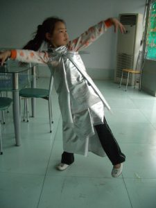
Yes, it was a tough tour of duty, but somebody had to do it. I will post photos of our walk around town. Liang-Li, who spoke the best English of the 3, is showing me Tai-Chi moves, in a square in front of the burial complex of the Song Dynasty Emperor Zhao Chen (the fourth emperor of the North Song Dynasty). If you look close in the photo, you will see many circles painted on the ground, all over the plaza. They mark off the positions for the scores of people who do their Tai-Chi exercises there, en-masse, every morning.
Dance in the Ice Cream Parlor
After the walk, we went to an ice cream parlor (also a photo somewhere on the post). There a funny, but memorable thing happened. A young girl came into the ice cream parlor and came up to our table and did a very impressive dance – expressive and graceful. When she was done, I thought I should give her some money, but she turned around and ran outside. I said to my three friends that I wished I could have given her a little money for her dance. They all said, no, that was not why she did it. They said she
Dance in the Ice Cream Parlor
saw me and want to do her dance for me. She would have not known what to do if I offered here some money. But, heck, she didn’t even wait around for my applause!
I am going to have more pictures than words in this post, so the pictures will run on. I will just describe them and I think it will be clear which pictures I am referring to.
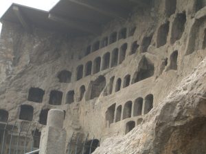
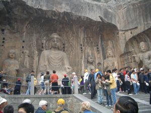
The Dragon’s Gate on the Yi River
In a couple of pictures, you will see statues of Buddha, and thousands of holes in the cliffs with Buddhas, Buddhas everywhere, tens of thousands of Buddhas. This is the Longmen Grottoes – directly translated, Dragon’s Gate Grottoes – or also Longmen Caves. They stretch along 12 kilometres (7.5 miles), in cliffs along the Yi River. I heard it also called “The Dragon’s Gate” because of the hills on each side of the Yi River.
Longmen Grottoes – , Dragon’s Gate Grottoes
I don’t know if I am saying something original now, or if I read it somewhere, but I found that, in China, you see something every day that you just don’t see every day!
The Longmen Grottoes – The Biggest Buddha, 57 Feet Tall
Look for the picture of the complaining telephone!
Then, I have included pictures of my main interpreter for my visits there, Donna. Many Chinese who work with us westerners take on an extra name, western names, to make things easier on us, I guess. Donna has worked at the UN in Geneva, and was a talented interpreter, and, in my opinion, beautiful. As I said, it was a tough tour of duty!
Complaining Telephone at the Longmen Grottoes
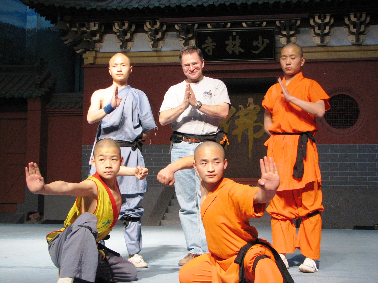
I went to Shaolin Temple more than once. It is famous for its famous form of Kung-Fu, Shaolin Kung-Fu. The temple naturally has monks. You will see a photo of a very important monk – it will be clear when you see the photo that he must be an important monk.
Shaolin Kung-Fu
Unfortunately, I don’t remember exactly why he was important. He could be that he was the head monk at Shaolin.
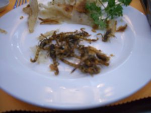
Our meals were always a spectacle! All served banquet style with food revolving around the center of the table with large centerpieces of flowers, andsometimes ice sculptures. You see me in a slightly blurred picture drinking a shot with a Chinese colleague – Ganbei! (A toast, which literally means “dry cup”!)
A Very Important Shaolin Monk
Another blurred photo, but I had to include it, showed one of the delicacies that I ate OFTEN at banquet meals – deep fried scorpions. I ask one of my Hosts about the possibility of getting poisoned by eating them. I was told that the poison sacks of the scorpions are removed before cooking, but the chef had to have
Banquet
great skill. I asked if our Chef had great skill. Oh, yes, he is brought in specially from Beijing. Well, that was a relief!
For my personal safety, you can see, at the very bottom of this post, the Kung-Fu bodyguards that accompanied me everywhere!
Yummy Deep Fried Scorpions
For a bit more completeness, I have included pictures I took of the famous cities of Shanghai, Hong Kong, and Beijing (at the Forbidden City).
Eating Scorpions,, Hoping that the Chef was Skilled
Again, I hope to start posting my “fresh” pictures, starting in my next post, after my trial shake-down walk on Tuesday.
But, I like these pictures and I have hundreds. Every trip to China was fascinating for me.
Ganbei!
In China, you see something every day that you just don’t see every day!
A Banquet with ColleaguesMy Interpreter, Donna, at Shaolin TempleShanghai at NightThe Bund or Waitan is a waterfront area in central ShanghaiBeijing – Me in Front of the Forbidden CityHong KongMy Bodyguards
Late Michigan winter kept early Michigan spring in a cold, snowy, vice-like grip – that is, until last Saturday, when it suddenly warmed up and all of the snow melted. It left THIS scene in the picture above just behind the house! The meteorologist on 9&10 News – our local news station (so local, in fact, that I can drive to its studios in under 10 minutes) – said that we will now enter Michigan’s “brown season” with winter’s dead brown still all around and spring’s renewal green not yet sprung. Look at the photo above, taken from the back deck! Really, what a depressing sight. Just like the meteorologist said, we are in “The Season of Brown.” I feel like throwing a beach ball or something bright-colored into the middle of that grass, it’s awful.
Okay, now to the walk…
Walk Preparations
End of Winter, Grüningen, Switzerland
When my co-walker Joel, who wrote the third post, agreed to take the C2C Walk with me, I had already read two books on the walk, but had nothing prepared. It is a popular walk, probably the most popular long walk in the UK. I needed to do something fast, I thought, especially about accommodations on the trail.
While Joel was waiting on one or two books about the walk that he ordered, I constructed an itinerary of our daily overnights. Studying my guide books, I put together a list of Bed & Breakfasts – B&Bs – for each stop, listing at least three B&Bs per overnight in order of my preference, which was based strictly on how my guide books described them – always selecting the ones written up as “old and charming, with exposed timber beams.” I am a sucker for timber beams. I sent the list to Joel, who checked “on-line” about all the mundane stuff, like whether the WC was en-suite or behind the cow shed (I got this very wrong on a couple of my suggestions), plus other considerations; for example, the quality of the big English breakfast they served (based on reviews) and whether the B&B was close to a good pub, or – better yet – had its own pub. Joel also happened to meet someone at the time, completely coincidentally, who had actually walked the C2C Walk. She had some other advice and suggestions for us.
I took on board all of Joel’s changes, and we, then, decided it would be more cost and time effective to have someone else – a professional – book the overnights for us. We used a service called Sherpa Van, which did a great job. If our preferences were already booked out, they suggested equally good alternatives. However, we still got most of our top picks. – And, if I had 250,000 subscribers, right now, I may have been able to charge money for that plug. But, I since don’t, it is a freebee for Sherpa Van.
The Panorama Way, above Braunwald, Switzerland
Okay, it’s true, one can also take this walk, by camping and/or staying in hostels, bunkhouses and camping barns. Hiking purists out there will certainly take exception to our cushy approach to the walk. However, Joel and I had both done that low-budget sort of youth hostel and camping travel extensively back when. (And, I maintain that I can still travel rough, if I want to! We just didn’t want to.) English B&Bs are famous for their charm. They would add to, not detract from, the C2C experience. We will sit in the evenings together with other C2Cers and recount amusing stories of our day on the trail over a pint of the local ale. Besides, we will have lightened our load by not carrying food, pots and pans, camp stove, tent and sleeping bags, and other gear. With smaller packs, we would enjoy the walk more, and take, certainly, better pictures, and also have a far better chance of outliving the trip.
After we booked our accommodations, we went about buying our plane tickets. It wasn’t planned, but we both will connect in Newark, New Jersey, to meet the same onward flight to Manchester, England. – Having all of the overnights and flights booked was an exhilarating feeling. What could stop us now, except possibly our joints and general cardiovascular condition?
But, it was also anticlimactic. Almost two weeks went by after all of the bookings were made without Joel and me even telephoning or emailing about our upcoming adventure. I was uneasy about it. Shouldn’t we be doing something? I sent Joel an email to propose a Skype call. He agreed that it was very necessary. We decided to discuss our packing list, in order to make sure that one of us didn’t have a good idea that the other one didn’t have.
Trailblaze on the Panorama Way, above Braunwald, Switzerland
Should we take three changes of clothes, or would two be enough? If we had washed out one set of clothes, and wore another set while the first set was drying, and something would happen to the clothes we were wearing, like spilling catsup on them at a fish and chips stand, then, with only two sets of clothes, we would have to wear the catsup. However, with three sets of clothes, we might be over-packed. We went back and forth on this and, then, deferred the decision and noted down 2-3 sets of clothes on our packing list.
What else? On the C2C Walk, there is not a question of “if” you will be rained on, but how many days you will be rained on. On the second day of the walk, on the hills above Borrowdale, the highest rainfall in England is recorded, an average of 4.7 meters of rainfall per year, that’s 185 inches! We would need rain gear, and we noted that down.
Lake near Gstaad, Switzerland
After 5 minutes of Skyping, including time spent exchanging some pleasantries at the beginning of the call, we had covered these two topics exhaustively. The call got a bit silent. Surely, there was more to work out. This was a complicated trip, after all. But, we couldn’t think of anything. I finally suggested that I might bring a hip flask with some bourbon in it. Whenever we reached the top of a hill, we could take a shot. That is what the Germans and Swiss call a “Gipfelwasser”- Summit Water. When you get to the top of a mountain, maybe we only have hills, you take a shot of “Gipfelwasser.” Joel ask if it shouldn’t be scotch instead, being England. I said I only had bourbon here, and I wasn’t going to buy a full bottle of good scotch, just to fill up a hip flask. Okay, we decided bourbon would be okay, and we noted that down.
Well, finally, we were getting somewhere with our preparations, and decided that that was enough for this first call. We would need to have another call sometime.
Comanche War Axe Tomahawk
Before I start taking pictures of the C2C Walk, I am short of fresh photos (excepting the dreary one at the top of this post), so I am including other pictures of past walks, plus whatever else strikes my fancy. Below, I have added a picture of my Comanche War Axe Tomahawk. I admit that I am including it in the post, because I thought it would be an eye-catcher in the blog title. So, what does a Comanche Tomahawk have to do with our walk? Well, nothing…
This Tomahawk is in a style that they call a Missouri War Axe. A Missouri War Axe is just the type of Tomahawk it is. My axe is more specifically attributed to the Comanche in southern Oklahoma, and dates back to about 1840. Pre-Indian Wars Tomahawks are rare. This one came out of a well-known collection, so the piece is well-documented. I have a small collection of Native American artifacts, and this is my latest addition. And, it is my fourth axe!
I asked my C2C walking buddy, Joel, to introduce himself. I will add that Joel is a New Yorker, but has lived the last few decades in San Francisco. For this post, Joel decided to describe how we met and his first impressions of England, many moons ago!
Joel – The Other Guy Blog
Every story has a beginning, a middle, and an end. This is true for the story of the upcoming walk across England, and so here is the very beginning, at least from my perspective. It started the first week of July, 1981…
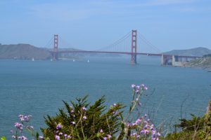
Golden Gate Bridge
For the very first time in my life, I was in Europe. A brash 22 year-old, still with my curly locks (now long gone), my flight from JFK had landed early in the morning at London’s Gatwick Airport. I remember wandering around the airport for a while, trying to get my bearings, learning the hard way that a restroom was a WC. Everyone looked different, talked different, and kind of acted different; people were eating beans and toast in front of an airport café.
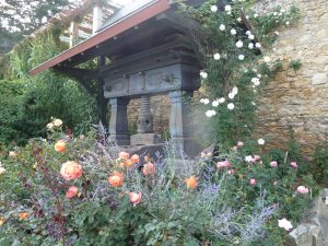
Garden in Eltville, Germany, where Joel and I met up a couple years ago, by chance.
I was in London to finish the last six credits of my college career, so I was armed with some traveling directions from the Study Abroad Office at The University of Michigan. “Take the train to London Victoria”, it said, and so I found a train bound for London’s Victoria Station. I had grown up tethered to New York City by the Long Island Rail Road, but this train was unlike the trains I had taken all during childhood from Syosset, Long Island, to Penn Station in Manhattan. There were seats grouped in fours which faced each other, there were luggage areas, and I later learned that I had accidentally purchased a round-trip ticket. Who knew that “return” meant round-trip? That turned out to be the start of a trend in which my months of travel would outlive my money supply. But that would be more of a worry a couple of months hence, and then a major problem a few months after that.
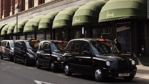
London Taxis in Front of Harrods
The train arrived at Victoria Station and I was instantly lost again. Victoria is one of the major train stations in London, and it is big, dirty, and confusing. At least that’s how it appeared to me that early morning in July, 1981. I checked the UofM directions again: take a taxi to Egerton House, with an address on Egerton Gardens in London, it said. I went outside and didn’t see any taxis, and then I realized that those big black cars were, in fact, taxis, so I got inside one and sheepishly tried to tell the driver where I was going. I kind of figured that the driver would have no clue, in all of London, where this address was. But then of course London taxi drivers are required to possess The Knowledge, which means they know how to find any of the 25,000 streets in the city. The test to prove The Knowledge is known to be one of the hardest exams of any kind, worldwide. Now this is all threatened by Uber, etc. But not so in 1981.
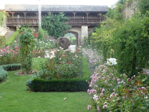
Eltville, Germany
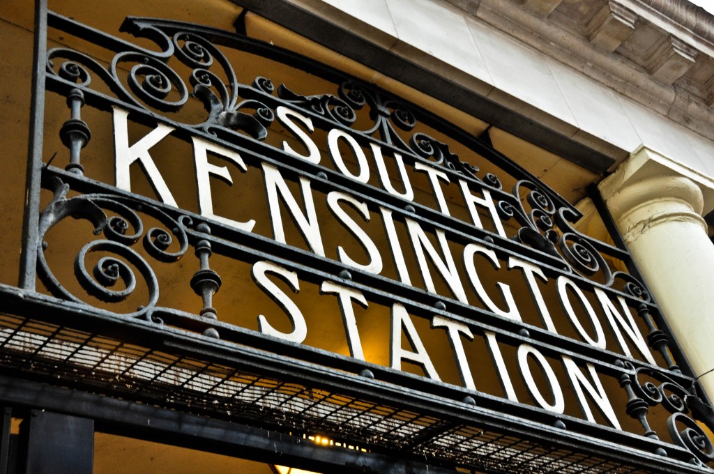
So of course my driver knew exactly where to go, and I sat in awe as he twisted and turned on all kinds of small lanes, alleys, and mews. I was just amazed to even be there, a looky-loo in the back seat [note how my terms become more and more British], just watching London rush by my window. We arrived at Egerton Gardens in South Kensington, an affluent section of London directly adjacent to the even more upscale Knightsbridge. Clearly my stay in London was not in a ghetto. Strike two against my money supply.
Egerton House, itself, however, was quite funky. I checked in at the desk; a guy with beads was playing some guitar chords in a common lounge behind me while a girl who appeared to be high as a kite was working out some lyrics. The furniture all looked like it came from the London branch of Goodwill; the sofa was taped to hide the stuffing coming out of the pillows, and one of the lounge chairs was held up by some kind of wood block where a chair leg should have been.
Embankment. London
I had brought two extra-large suitcases to London, each filled to capacity and each weighing around fifty pounds. One couldn’t spend a couple of months in London without four pairs of jeans, dress shoes, hiking boots, dress clothes, basically everything I owned. My room was on the top floor, which turned out to be up many flights of a long, narrow, switchbacking staircase. I squeezed and hauled those heavy suitcases until I finally reached the top, sweating profusely and quite frankly gasping for air. It had been a long journey, and now I had finally made it to my room and had just one thought in my head: a nap.
I opened the door, and inside were three beds in a single row. The two beds on the ends were empty; there was somebody sleeping in the middle bed, starting to stir as I noisily shoved open the door. But I was immediately distracted by the sound of water to my right, so I looked and saw a sink that was leaking water, a drop at a time, into a bucket. But the bucket was full, and each new drop displaced another drop of the water in the bucket, so there was a pool of water on the floor, most likely dripping down to the room below. I turned my gaze to the idiot in the middle bed and suggested that maybe something more needed to be done with this plumbing situation. He didn’t deny that, but at the same time seemed pretty indifferent. But he did at least sit up, stick out his hand, and introduce himself:
“Hi, I’m Jeff,” he said. “I think we’re roommates.”
Yes, every story has a beginning, a middle, and an end. And this was the beginning – the very beginning – of the story of our walk across England, some 37 years later.
A quick note to Joel’s account of our first meeting in Edgerton House, South Kensington: We were on a summer study program in London. The summer of 1981 was famously the summer of the royal wedding of Prince Charles and Lady Di. Joel and I were, in fact, directly present that day at the wedding, together with a few million other people on the streets of London. Joel slept on a curb the night before with some other people from our program, in order to be “curbside” for the street wedding procession the next morning. Me? I had met an attractive young woman from Zimbabwe at the restaurant ‘Pizza on the Park’ at Hyde Park Corner the evening before. We all went to a ‘pre-royal wedding party’ and then went to Hyde Park to watch the fireworks. My new Zimbabwean friend was staying with relatives in northern London, far away. So, in order that she could see the wedding the next morning, I gallantly offered that she could crash that night in my dorm room, which was right nearby the next day’s action. Well, as we arrived at the procession route in the morning, the crowd on the street was already so thick that we couldn’t see anything of the parade except the tops of carriages going by and the feathers on top of some funny military hats, bouncing up and down on top of heads of Royal Horse Guards. I hoisted my new friend onto my shoulders to take photos, but they were film photos, so I don’t have a clue where they are now. After this summer in London, Joel and I – as I wrote in the fixed pages to this blog, please read the fixed pages! – anyway, Joel and I hitchhiked from London to Edinburgh. On the way up, we rode directly past Robin Hood’s Bay, the end point of our C2C Walk!
I was thinking. If I titled this blog post simply “Mobile Blogging”, who would even open it up?
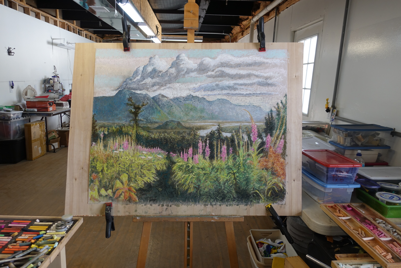
‘Lazy Mountain’ is a mountain in Alaska, which I summited with my buddy Tim – pretty recently, I think, just 10 or 15 years ago, maybe longer.
And, as for mobile blogging, that, of course, is my problem to sort out, not yours. But, it is the heart of travel blogging, and I need to master it – like really quickly master it, like before I hit the trail master it, which is coming up, like, really soon. ‘Up Lazy Mountain’, then, I admit, may have been a ruse to get you to read at least to this point. Though, don’t sign off yet – I need you still! Besides, there are still painted wild flowers, plus my friend Roman’s ancient farmhouse in Ticino, Switzerland, coming below – and I can work out the kinks of ‘blogging on the go’ while you look at my nature paintings.
“Wild Flowers” Oil
Those of you living in this part of the world may have been suffering along with me, but Michigan has had a winter storm warning for three straight weeks running, and is getting pummeled relentlessly with snow and hail and sleet! It has thrown me off my fitness schedule (though, I confess, I do have a fitness club I could go to and a fitness coach, who may even be reading this with disapproval – and since he is a former NFL and college football player, I don’t like getting him upset with me). The winter weather has driven me to indoor activities, so I opened up my boxes of pastels and started painting, plus drinking a lot of coffee and wine, depending on time of day. I should be outside walking or at the fitness studio, but, hey, I still have 3 whole weeks until my flight, and the weather forecast is looking up. I will be fit on time – pretty sure, anyway.
I am going to show photos of three of my paintings, which I have in progress right now, all of nature, to keep with one theme of my walking blog – nature. Now, in order to get these photos plus text onto this blog post, I will have gone through all of the steps for ‘blogging on the go’. I took these photos just today with my new tiny super-intricate compact camera that I don’t quite comprehend at all. I will transfer these photos, via my camera’s portable Wi-Fi hotspot, onto my iPad, and from there I will write and then publish a post to ‘A Long Walk’ – www.a-long-walk.com (make sure you book-mark it under your “Favorites”!). I have confidence in succeeding here, because, I figure, if you are reading this right now and you see pictures, then I will have been successful. If you are not seeing this, then you would not know if I was successful or not, because you would not even know if I tried or not. In fact, there is no way that I can blow this and have anyone find out. You might only start suspecting something, if you never hear from me again.
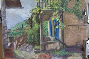
“Farmhouse and Rustica”, Ticino, Switzerland
Back to my paintings – last summer, my good friend Roman invited me to his old farmhouse in Ticino, Switzerland. It is the Italian part of Switzerland, with beautiful mountains and valleys and ancient villages – and good food and wine! I took a photo from the courtyard of his farmhouse overlooking Valle Maggia. I was sitting at a table outside with a nice glass of Ticino Merlot red wine, with his 200 year-old farmhouse on my right and his even more ancient, at least 500-year old, Rustica on my left. I felt great, and remember the scene serenely. So, I started a pastel from that photo, too. I have a lot of finishing up to do on the pastels. However, I may just leave the oil as is. You can fumigate yourself by oil painting inside, so I will wait until summer when I can ventilate better.
Okay, I will now try to publish this. It was actually much harder to do on an iPad versus my computer than I had hoped, but an iPad is the only way to go while on the trail. Let’s see how this looks. I have no clue, and will see it for the first time when you all do – it looks a little scrunched up on my iPad screen. For those of you who have signed up on my site, thank you! You should all receive an email alert when this gets “published.” I am going to push the button NOW. That’s it, here it goes!